Unveiling the Rich Tapestry of the Sugar River Region: A Journey Through Time, Sustainability, and Natural Splendor
Unveiling the Rich Tapestry of the Sugar River Region: A Journey Through Time, Sustainability, and Natural Splendor
Written by Isabel Marsigli on February 15, 2024.
Nestled amidst the verdant landscapes of western New Hampshire lies the Sugar River Region, beginning at Lake Sunapee and ending at the Connecticut River. Every bend in the Sugar River of Sullivan County tells a story of resilience, ingenuity, and stewardship.
First Peoples, Early Settlement and Industrial Ingenuity
The roots of the Sugar River Region stretch back before colonialism, when the peoples of the Algonquin language group, specifically the Abenaki people, were the first to steward the fertile land. Unfortunately, not much is remembered of the indigenous history of the region, as relations between European settlers and indigenous peoples were challenging and negatively impactful. Drawn by the promise of opportunity and abundance, European expansion resulted in the displacement and marginalization of indigenous communities as they established settlements along the banks of the Sugar River. However, these settlements laid the groundwork for a region steeped in industrious and entrepreneurial fervor. From the mills that harnessed the power of the river to the bustling town centers that emerged as hubs of commerce and culture, the early settlers’ legacy serves as a testament to the transformative power of human endeavor.
According to historical records, the population of the Sugar River Region experienced a steady increase throughout the 19th century, with Claremont, one of the region’s principal towns (now the only city in Sullivan County), boasting a population of over 10,000 by the late 1800s. The proliferation of mills along the Sugar River also reflected the region’s rapid industrialization, with over 40 mills operating within its confines during this period.
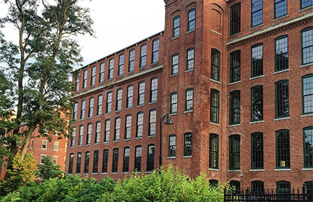
Claremont Mill. Image Credit: Catharine Britt on Shutterstock.
The Railroad’s Impact on Connectivity and Commerce
The dawn of the railroad era in the mid-19th century heralded a new chapter in the Sugar River Region’s storied history, one characterized by unprecedented connectivity and economic prosperity. With the completion of the Sullivan Railroad Company’s line through the valley, the region found itself woven into New England’s burgeoning transportation network, facilitating the exchange of goods, ideas, and cultures. The Sugar River Region blossomed into a vibrant center of trade and commerce, its fortunes intertwined with the iron rails and covered bridges (read our 10 Bridges in One Day Driving Tour here!) that crisscrossed its landscape, linking towns and villages with distant markets.
The Sullivan Railroad Company‘s inaugural line, completed in 1849, connected Claremont to the city of Concord, marking the beginning of the region’s transformative journey into the railroad age. Over the ensuing decades, the railroad network expanded exponentially, with multiple lines radiating outward from Claremont and Newport, facilitating the efficient transport of goods and passengers throughout the region and beyond.
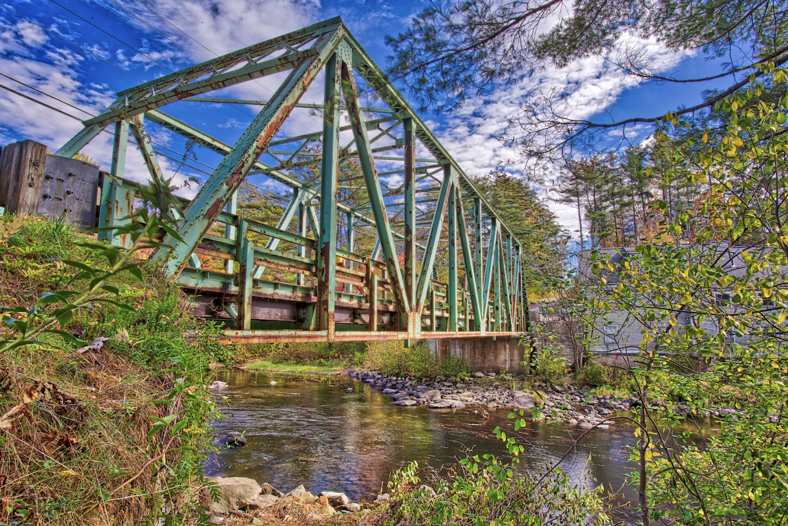
Newport NH Old Truss Bridge. Image Credit: Edward Fielding on Shutterstock.
The Agricultural Legacy of the Sugar River Region
As the region began to progress and transition from an industrial powerhouse to a sort of haven for agriculture, the hills of the Sugar River Region were assumed by the region’s farmers and homesteaders. Dairy farming emerged as the cornerstone of the region’s agrarian economy, with generations of farmers tending to their herds with care. By the late 1800s, dairy farming had emerged as the predominant agricultural activity in the Sugar River Region, with over 200 dairy farms operating within the confines of Sullivan County alone. The region’s reputation as a hub of dairy production continued well into the 20th century, with Claremont earning the moniker of the “Dairy Center of New Hampshire” in recognition of its pivotal role in the state’s dairy industry.
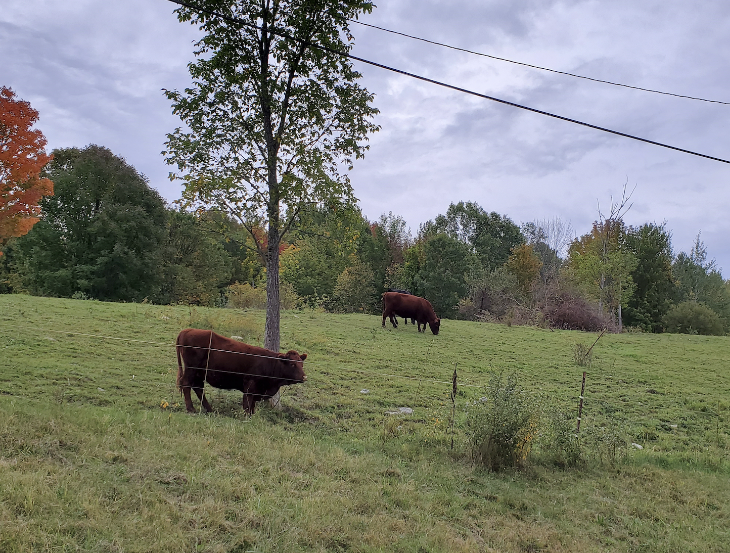
Cows in Pasture Behind the Sullivan County Health Care Facility in Unity. Image Credit: Sullivan County Government.
The Great Flood of 1936 and the Triumph of Resilience
In the annals of the Sugar River Region’s history, few events loom as large or cast as long a shadow as the Great Flood of 1936, an epic deluge that entirely altered the landscape and the lives of those who resided in the region. Initially caused by torrential rain and snow melt, the floodwaters surged down the valley with such a force that towns and villages were detrimentally affected, sweeping away homes and businesses, and leaving a trail of devastation. Yet, even in the face of unimaginable loss and hardship, neighbors banded together to lend a helping hand, communities rallied to rebuild from the rubble, and hope emerged within the community.
The Great Flood of 1936 stands as one of the most catastrophic natural disasters in New Hampshire’s history, with floodwaters reaching depths of over 20 feet in some areas and causing extensive damage to infrastructure, including roads, bridges, and buildings. The toll on human life and livelihoods was immeasurable, with estimated property losses totaling millions of dollars.
| River Basin | Location | Peak Flow | Peak Stage |
| Penobscot | Bangor | 130,000 cfs | |
| Penobscot | W Enfield | 125,000 cfs | |
| Kennebec | Waterville | 154,000 cfs/36 csm | |
| Androscoggin | Auburn | 135,000 cfs/41 csm | 27.6 ft * |
| Saco | Conway | 40,000 cfs/106 csm | |
| Merrimack | Lowell | 173,000 cfs/37 csm | 68.40 ft * |
| Pemigewasset | Franklin | 54,000 cfs/54 csm | |
| Pemigewasset | Plymouth | 65,400 cfs/105 csm | 29.0 ft * |
| Natchaug | Willimantic | 14,200 cfs/84 csm | |
| Quinnebaug | Quinnebaug | 90 csm | |
| Westfield | Westfield | 48,200 cfs/97 csm | |
| Connecticut | Dalton | 48,300 cfs/32 csm | 25.6 ft * |
| Connecticut | Montague | 236,000 cfs | 49.2 ft * |
| Connecticut | Thompsonville | 282,000 cfs | 16.6 ft * |
| Connecticut | Hartford | 313,000 cfs/29.8 csm | 37.6 ft * |
| Housatonic | Stevenson | 69,500 cfs |
National Weather Service, Historic Flood March 1936
Sustainable Tourism and Conservation in the Modern Age
As we navigate the complexities of the 21st century and confront the challenges of a rapidly changing world, the Sugar River Region remains consistent in its commitment to preserving its natural beauty, cultural heritage, and way of life for generations to come. From the region’s forests and pristine waterways that are home to countless species of flora and fauna to the villages and historic landmarks that bear witness to centuries of true community, the region’s bounty is as vast as it is diverse.
The Sugar River Region has made significant strides in promoting sustainable tourism and conservation, with over 30% of its land designated as protected open space. Local organizations and businesses have implemented a range of green initiatives, from energy-efficient practices and waste reduction programs to habitat protection efforts and rehabilitating and revamping beloved cultural activity sites, all aimed toward minimizing the region’s environmental footprint and ensuring its long-term viability as a destination for travelers seeking to connect with nature, culture, and community.
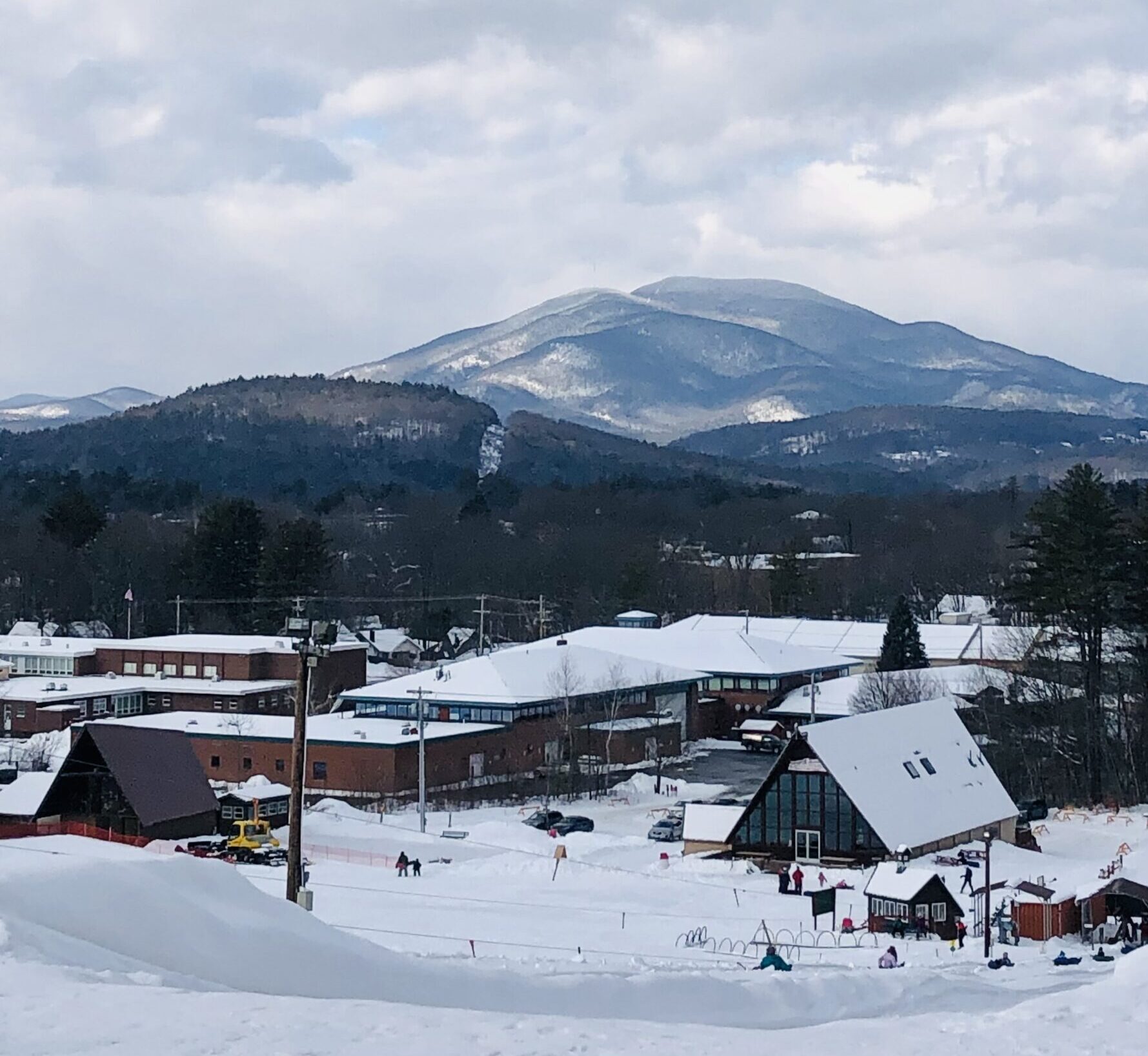
Arrowhead Recreation Facilities in the Winter, Claremont. Image Credit: Sherry Pardy.
Charting a Course for a Sustainable Future
As we bring our journey through the Sugar River Region to a close, our team invites you to reflect on the timeless lessons and legacies that define this remarkable destination. From the pioneering spirit of its early settlers to the resilience of its communities in the face of adversity, the Sugar River Region stands as a testament to the human capacity for true stewardship.
We invite you to catch up on our other new blogs and to attend the next Sugar River Social to learn more and get involved! Stay tuned for more blogs to come in our history series.