The Sugar River Region’s Historic Covered Bridges: 10 Bridges in One Day Driving Tour
The Sugar River Region’s Historic Covered Bridges: 10 Bridges in One Day Driving Tour
Written by Madeline Ferland on October 24, 2023.
Did you know that there are approximately 750 historic covered bridges still intact and in use across the United States? Among these, Sullivan County has a collection boasting ten of the most enchanting and historically significant covered bridges. Each of these bridges, celebrated for their timeless beauty, holds a truly important place in our region’s history. In fact, every single one of the covered bridges on this tour has earned its spot on the esteemed National Register of Historic Places.
With my Dad on a chilly rainy October day, I completed this all-encompassing tour spanning from Langdon to Plainfield. We started in Claremont and drove through Newport, then hit the southern loop through Langdon and Acworth, and continued up to Cornish and Meriden, finally ending the northern loop by driving back down to Claremont. You can, of course, start from anywhere in the region, but any way you go about it, it’ll be about a three to four hour excursion.
Click on this map to see the Covered Bridges Tour Route that I took:
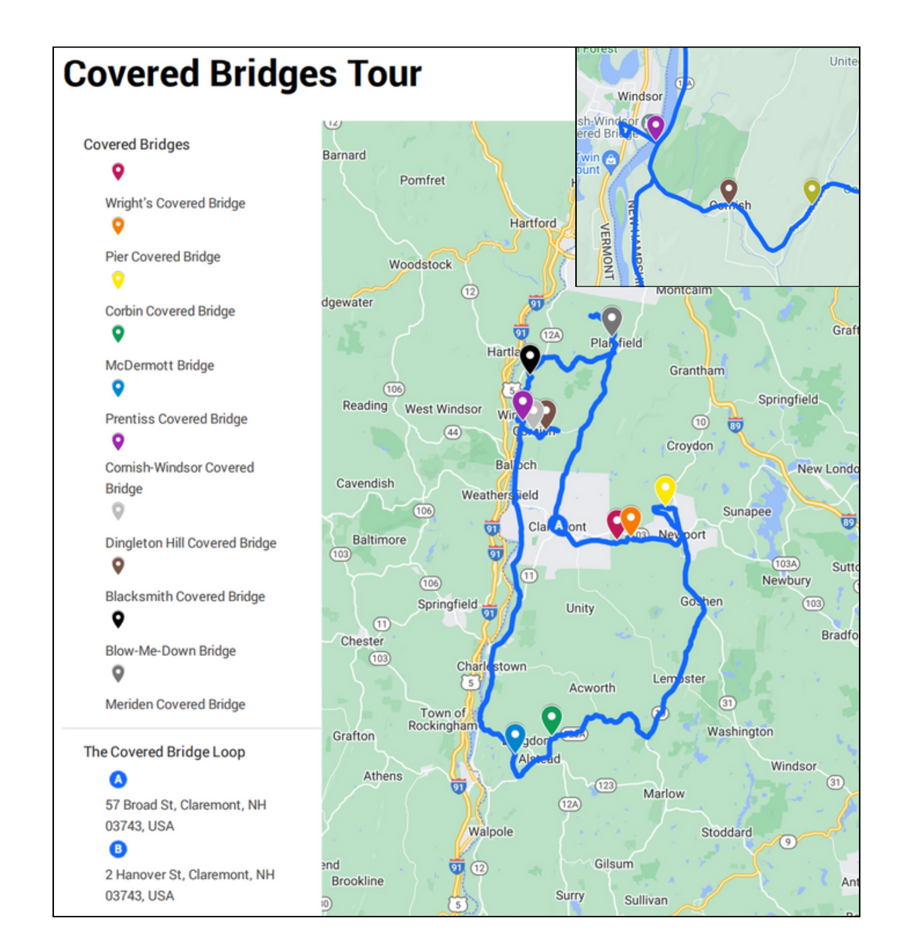
Total Distance: ~ 97 miles
Suggested Tour Time: 3 – 4 hours
Depending on how many stops you make and how long you stay, it might take longer. Naturally, we stopped at a few country stores, including the South Acworth Country Store and the Plainfield Country Store. At the South Acworth store, I bought a small glass of chocolate milk from McNamara Dairy Farm (the best chocolate milk I think I’ve ever had) and we both got absolutely amazing tasting sandwiches, stuffed grape leaves (aka dolma, yum!) and paprika-covered deviled eggs, all homemade from the Plainfield store. I adore locally made food products and treats, so stopping at local stores on this Sugar River Region tour is a must-do for you too.
We drove by a few other local and country stores that we’ve frequented before, such as 12 Percent Solution in Cornish and the Meriden Deli Mart. There’s also quite a few businesses that I’d never known existed. That’s one of the amazing things about taking the time to be a tourist in your own home region – you get to see such beauty you never really noticed before! I especially loved looking at the beautiful old homes and the still vibrant color on the trees (although the leaves haven’t been as red as they are usually, this has felt like the longest fall season ever, and I’m certainly not complaining!).
Drive this route yourself and join me in discovering the rich heritage and scenic allure of these iconic covered bridges in our beloved Sugar River Region.
Wright’s Covered Bridge
Wright’s Covered Bridge runs along the Sugar River Trail between Claremont and Newport. Since it’s part of the rail tail and is not directly near the road, it is a few minutes walk to actually reach the bridge. There isn’t much parking except for where the rail trail intersects with the road. Wright’s was built in 1906 by the Boston and Maine Railroad with a double Town/Pratt lattice truss, which was a popular style of covered bridge construction.
Fun Fact: When rail traffic still passed through the bridge, it was the wooden laminated arches that supported most of the weight rather than the trusses.

Front View of the Bridge. Image Credit: Madeline Ferland.

Wrights Covered Bridge Informational Sign. Image Credit: Madeline Ferland.
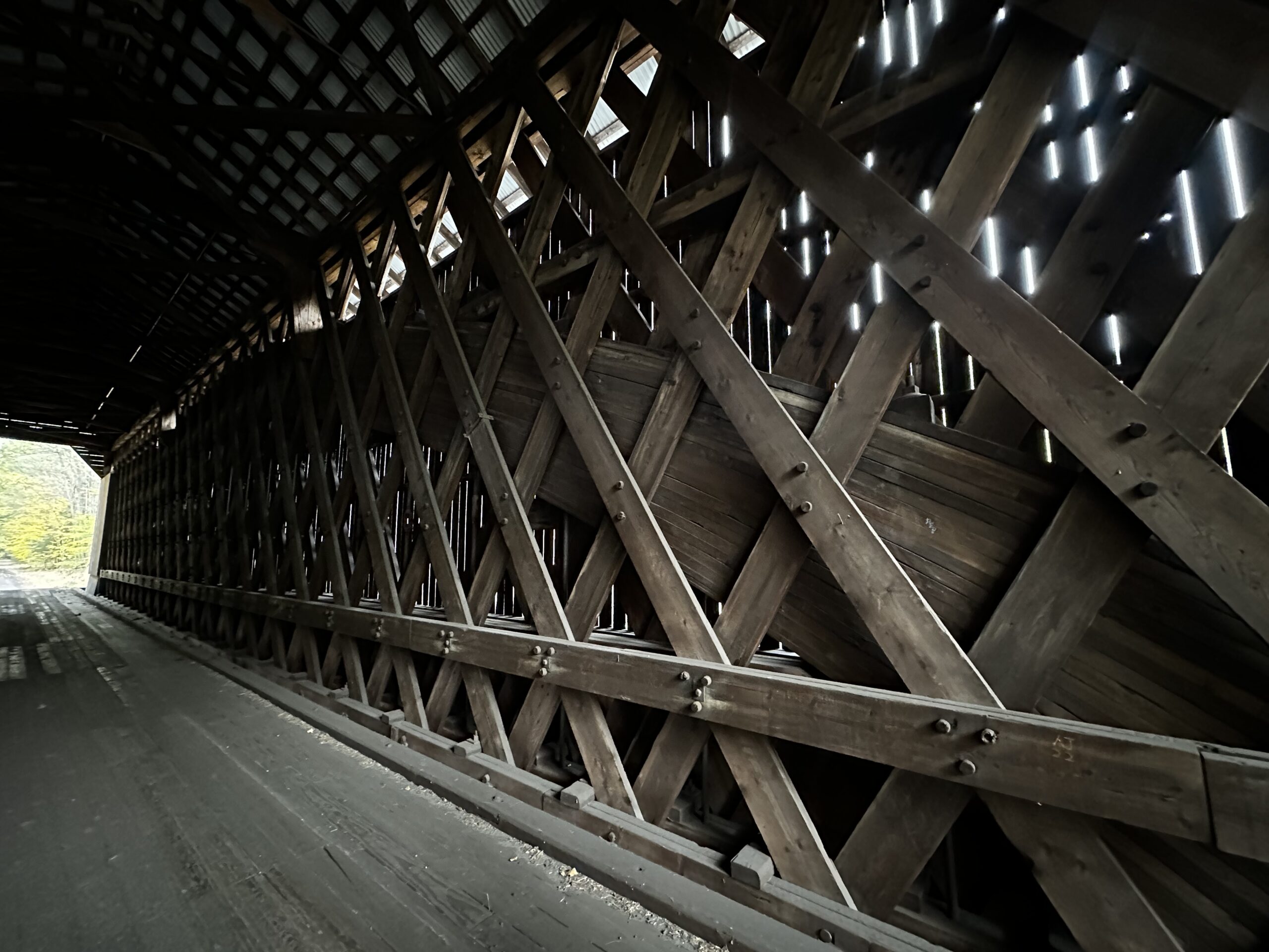
Interior Arch, Wrights Covered Bridge. Image Credit: Madeline Ferland.
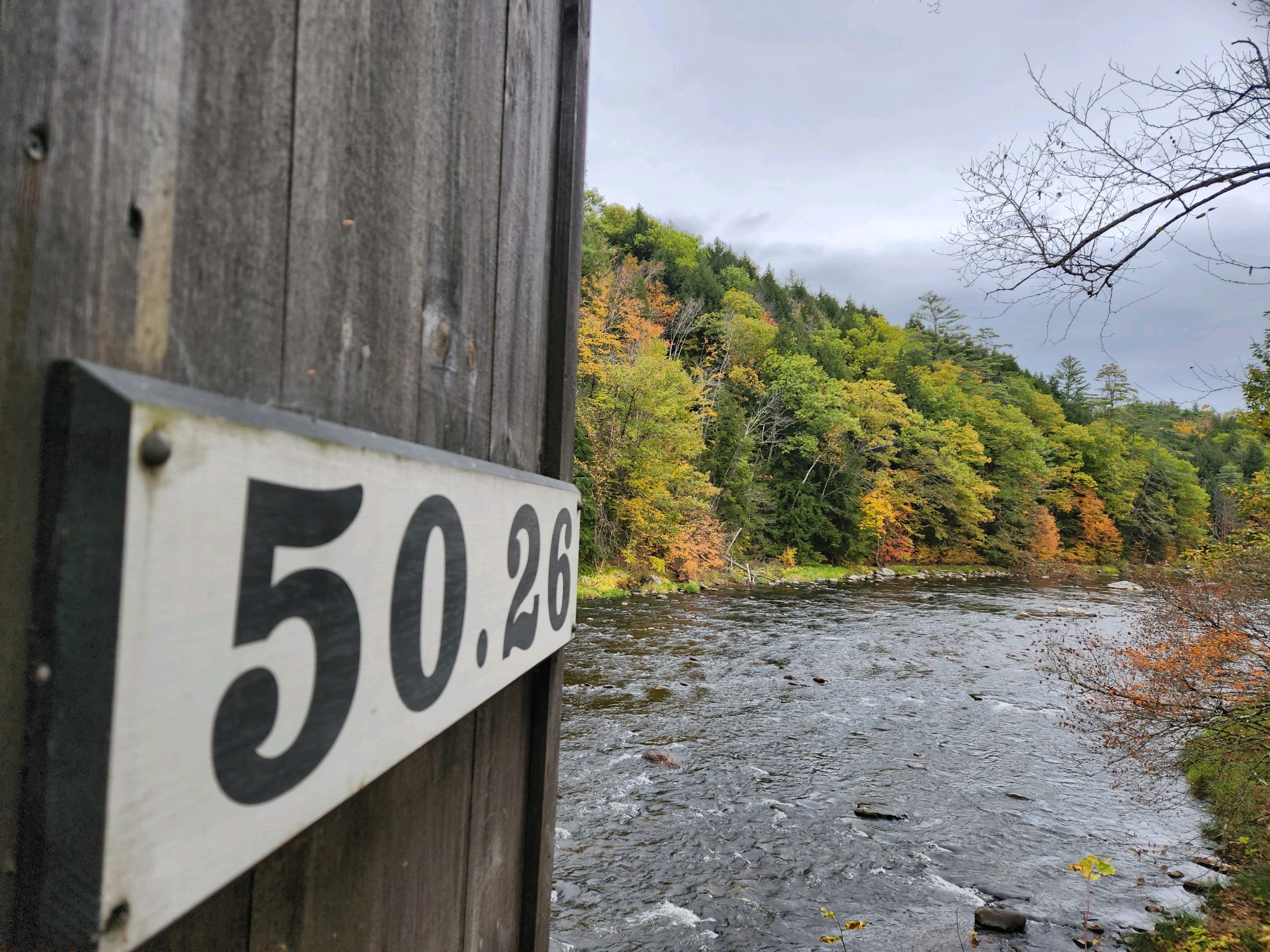
50.26 Sign. Image Credit: Madeline Ferland.
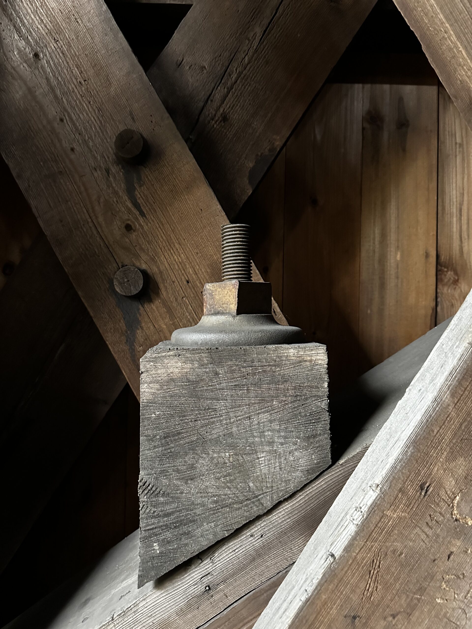
Original Nut and Bolt, Wrights Covered Bridge. Image Credit: Madeline Ferland.
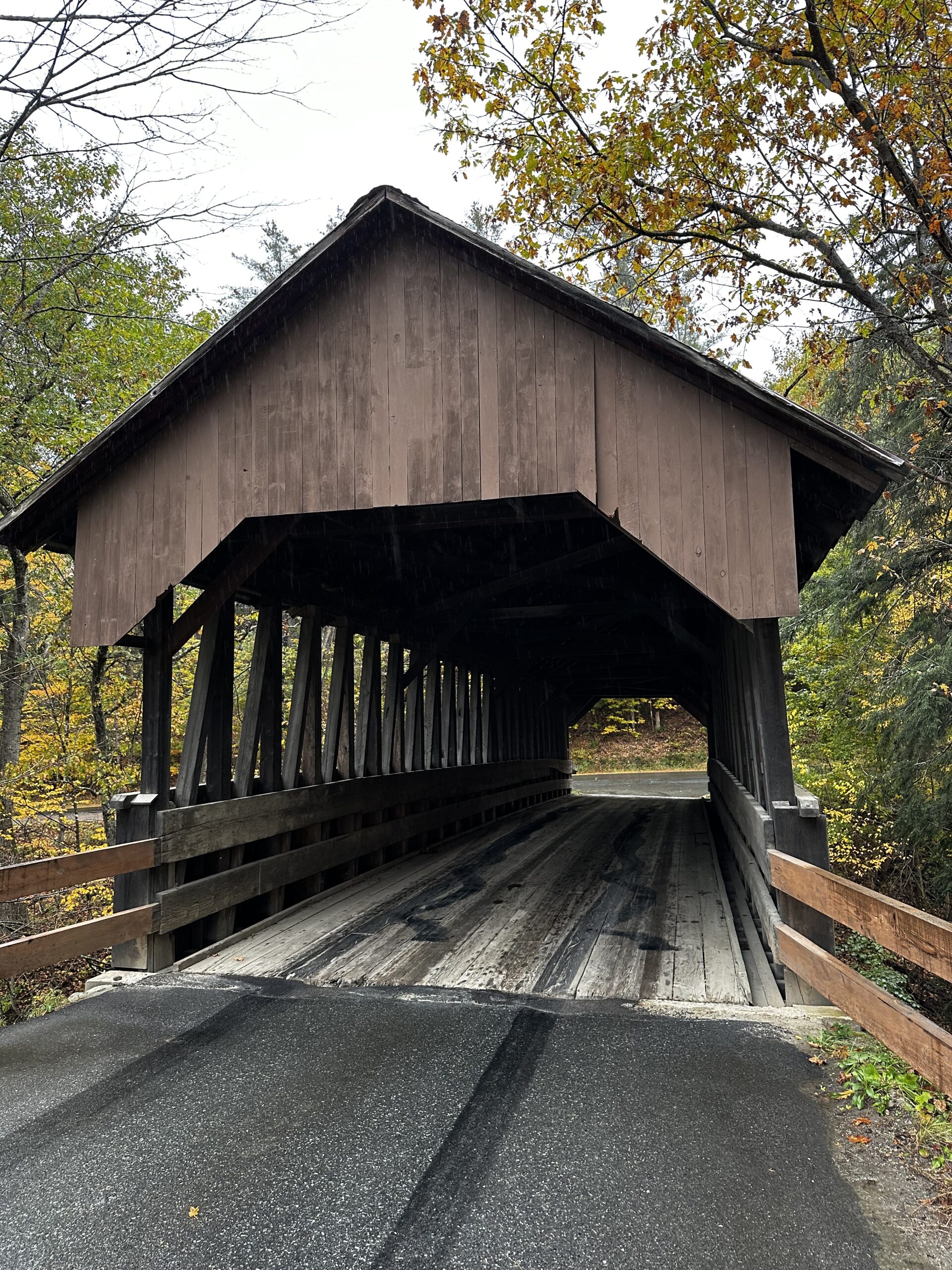
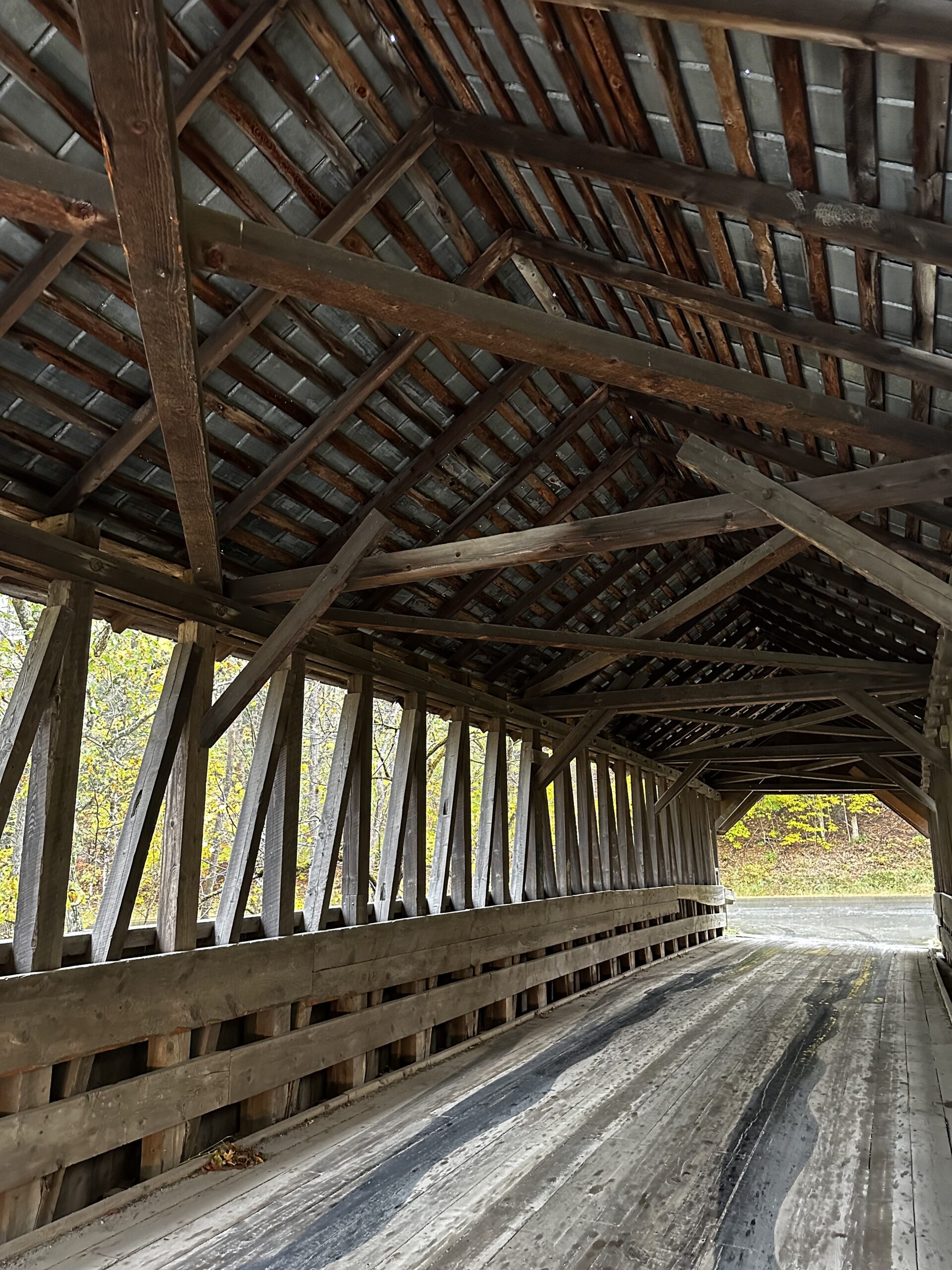
Pier Covered Bridge
The Pier Covered Bridge also runs along the Sugar River Trail following Wright’s (if you’re going from Claremont to Newport). It’s also located just off the road, but is less of a walk than to Wright’s (that’s if you park in the pull-off just before the bridge and use the access stairs). It was built in 1907 also by the Boston and Maine Railroad and, of course, was constructed with a double Town/Pratt lattice truss.
Fun Fact: It is the longest of the 8 covered bridges that were originally built for the Boston and Maine Railroad.
Pier Covered Bridge. Image Credit: Madeline Ferland.

Pier Covered Bridge Informational Sign. Image Credit: Madeline Ferland.
Pier Covered Bridge Interior. Image Credit: Madeline Ferland.
Wooden Pegs Details. Image Credit: Madeline Ferland.
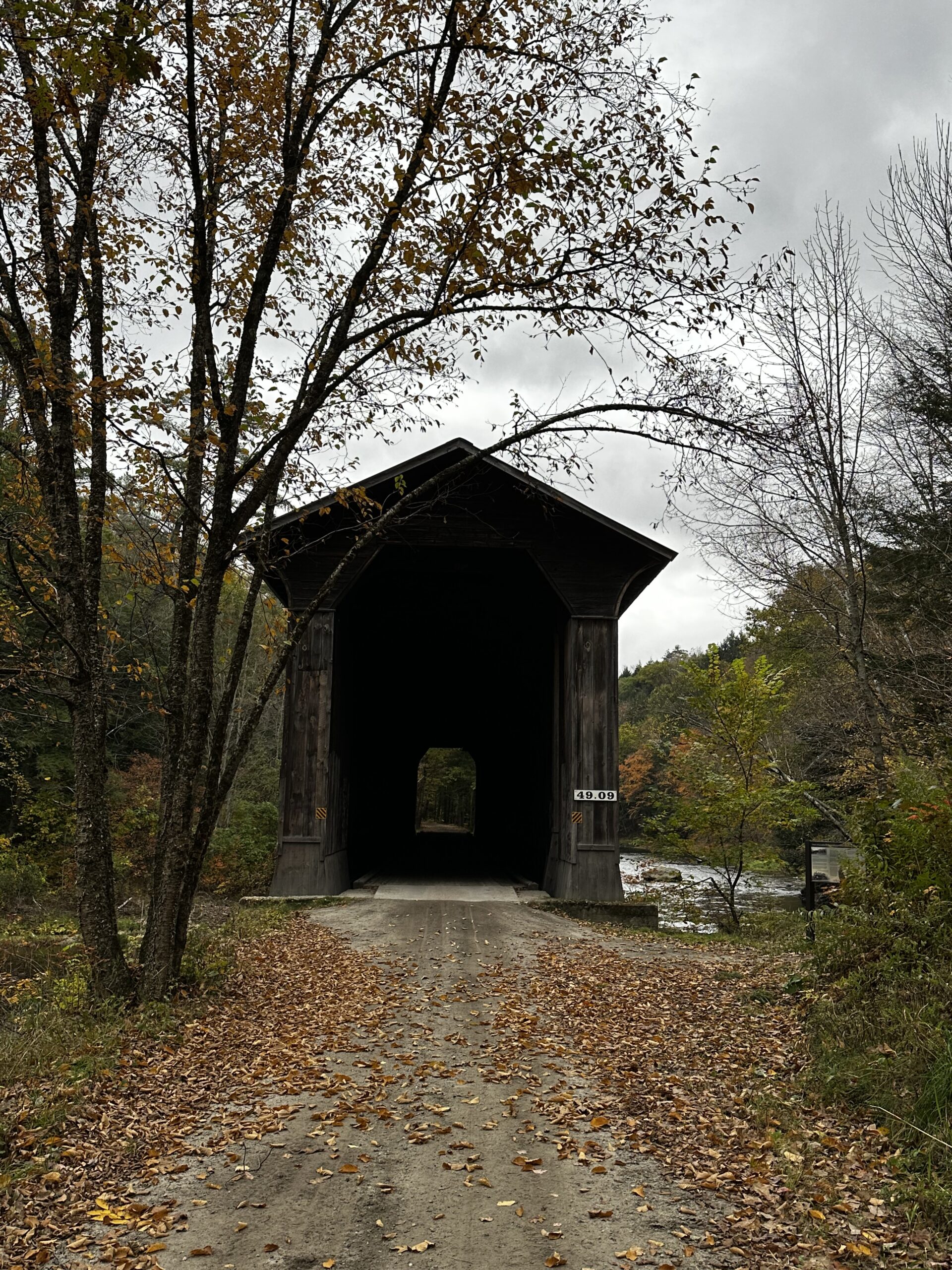
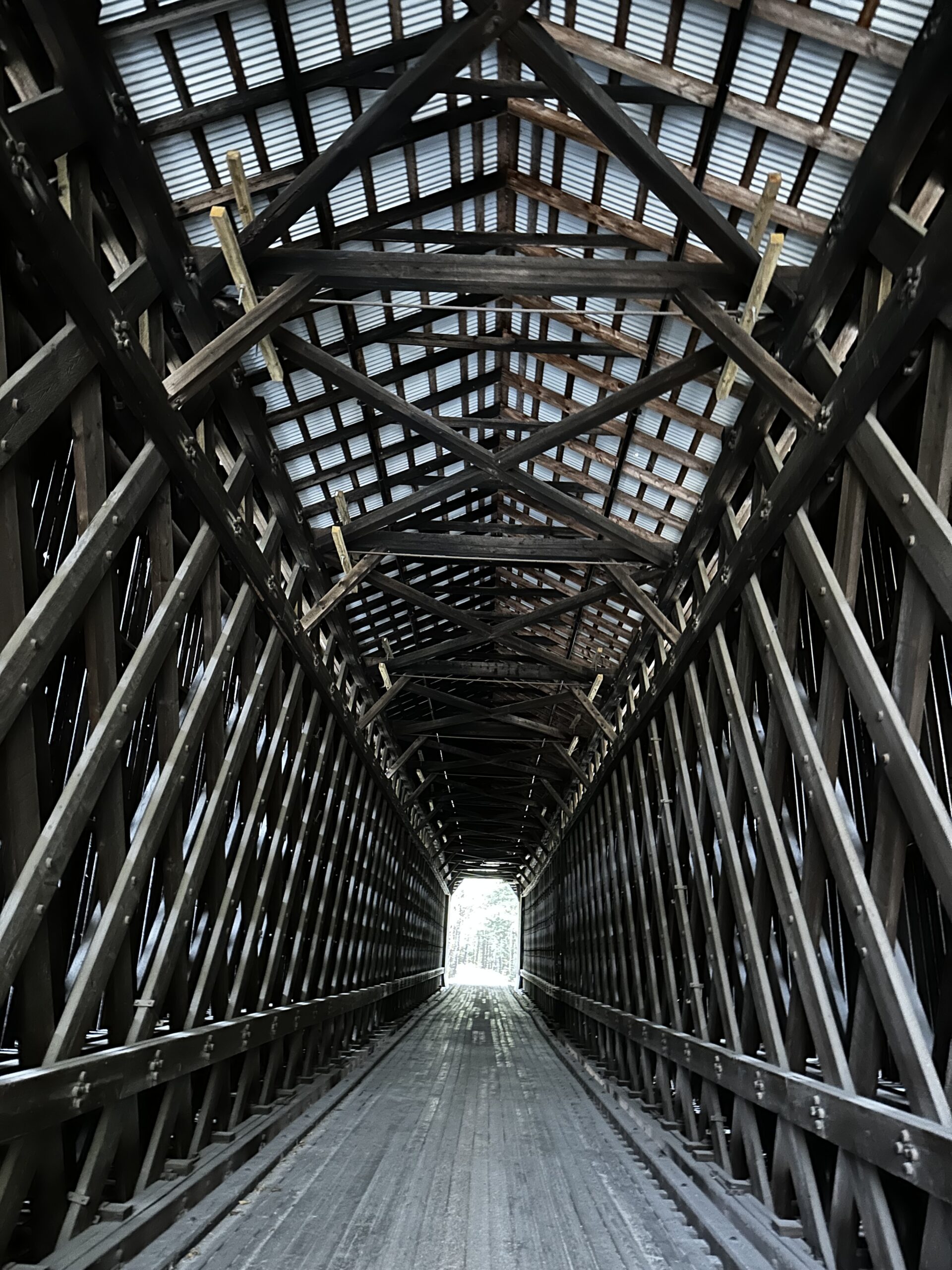
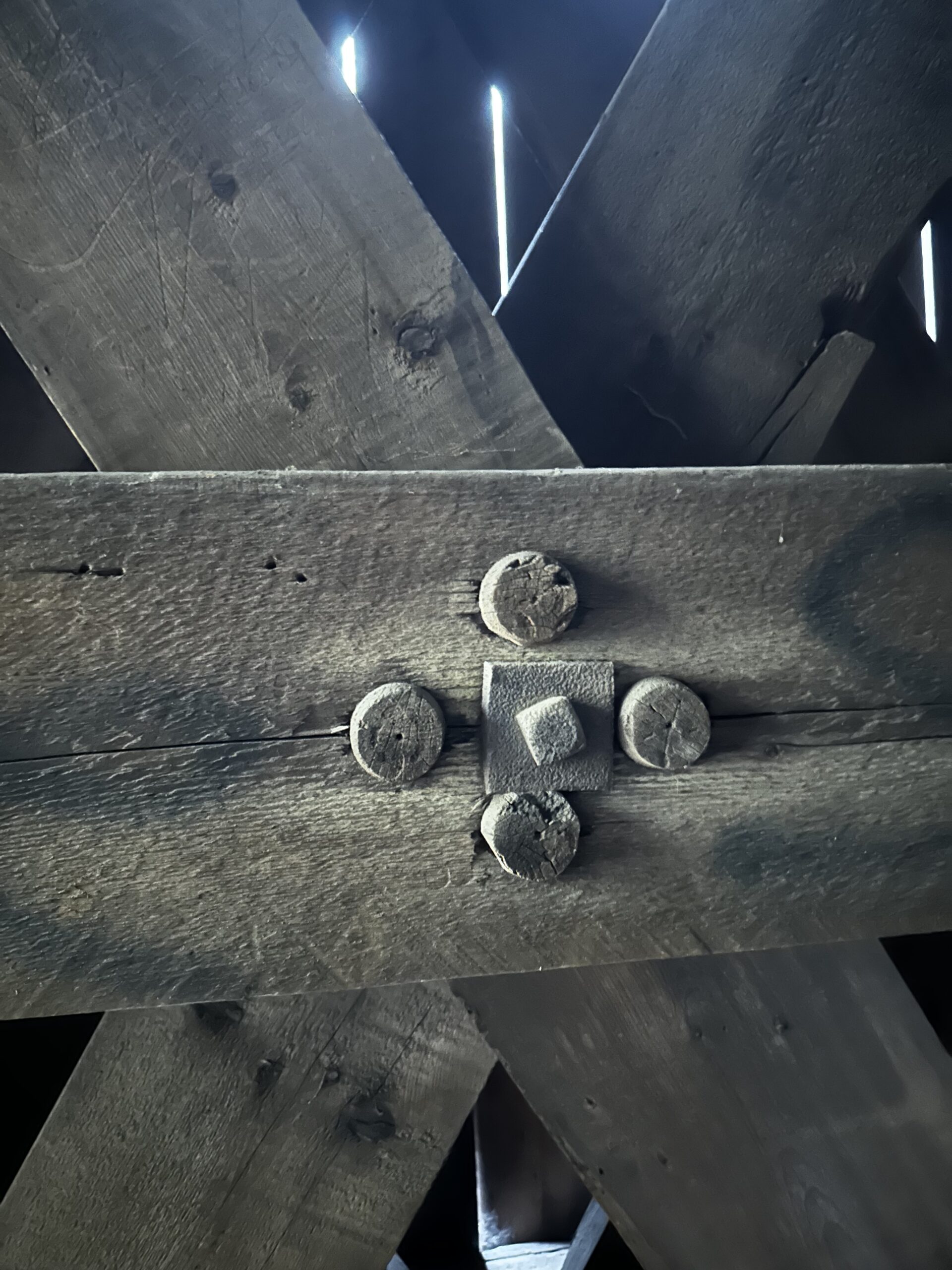
Corbin Covered Bridge
The Corbin Covered Bridge is located on North Newport Road over the Croydon Branch of the Sugar River, just a couple miles north of Newport. It was constructed somewhere around 1845, but the exact date is unknown. In 1993, the bridge was destroyed by a fire but completely rebuilt not long after. Today it stands strong and allows for small vehicle passage.
Fun Fact: Where the Corbin Bridge is located is not just a historic covered bridge site, it’s also a park. There you’ll find picnic tables, river access, and great spots for fishing.

Corbin Covered Bridge. Image Credit: Madeline Ferland.

Corbin Covered Bridge Interior. Image Credit: Madeline Ferland.
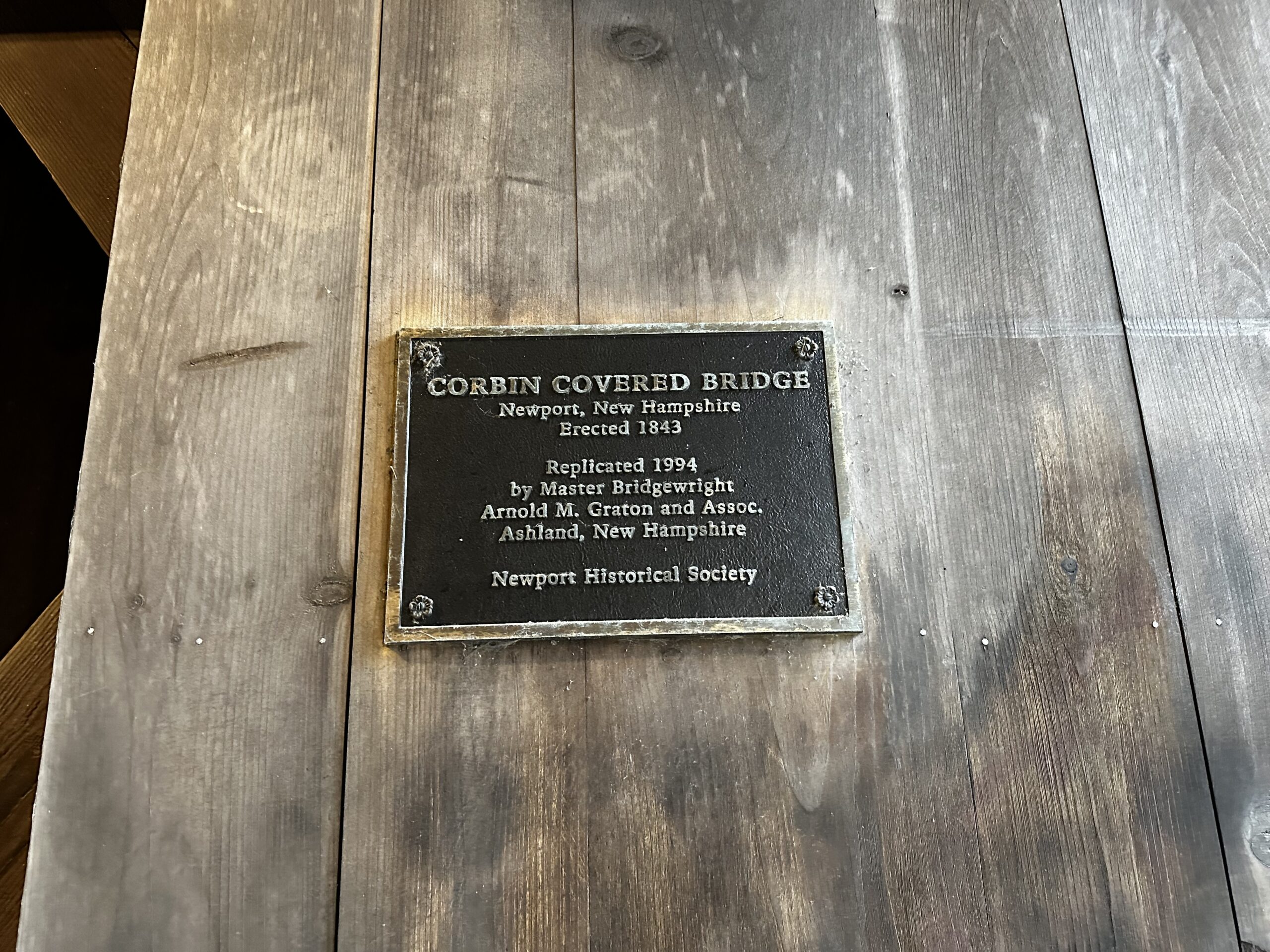
Corbin Plaque. Image Credit: Madeline Ferland.
McDermott Covered Bridge
McDermott Covered Bridge is located just north of Route 123A in Langdon, about two miles north of Alstead. It was built in 1869, the third and final version of bridges at this site (the first three were built in 1790, 1814, and 1840). It is no longer open to vehicle passage but remains a footbridge.
Fun Fact: Another name for the McDermott Covered Bridge is the “Cold River Bridge”.
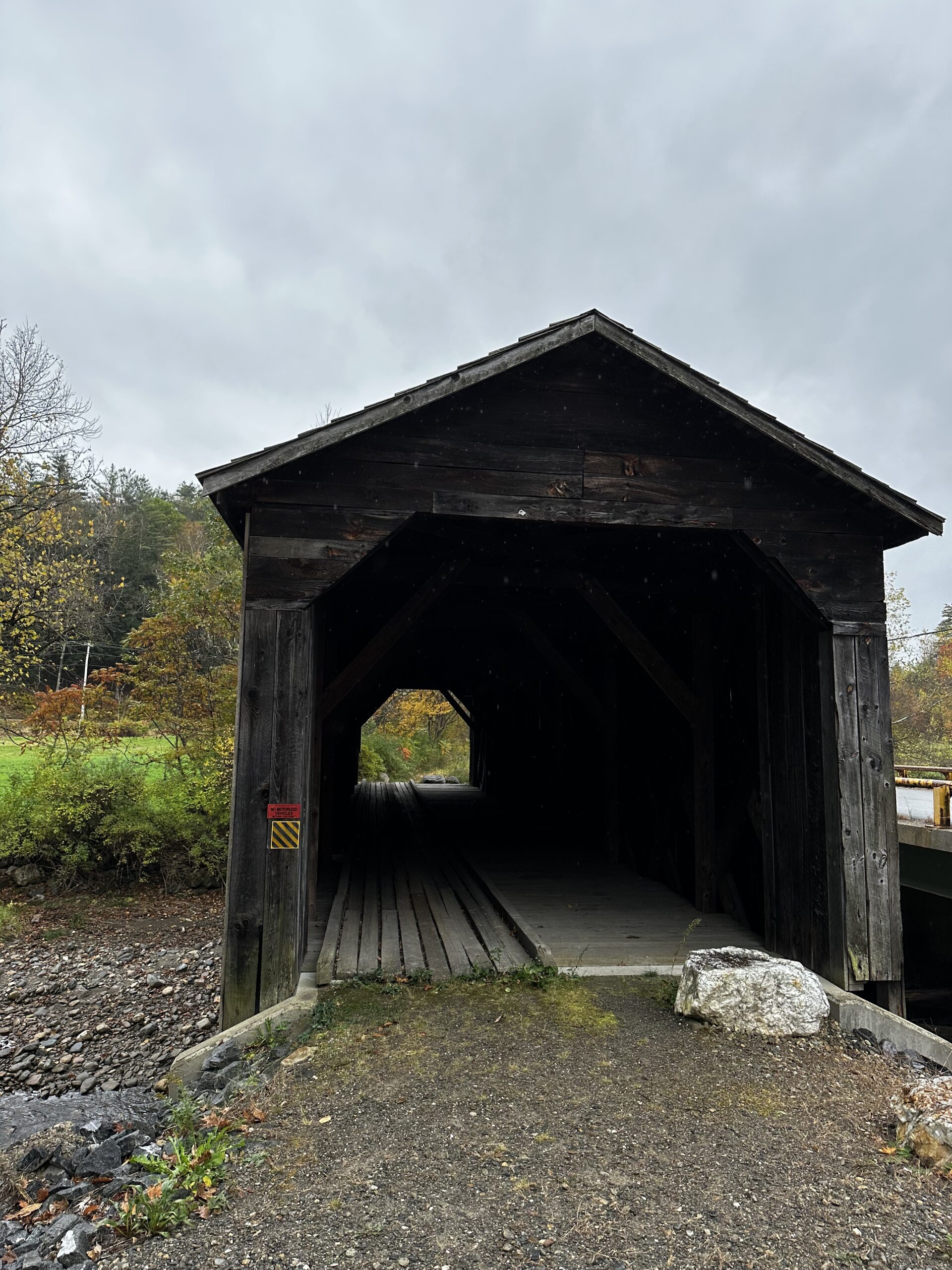
McDermott Covered Bridge. Image Credit: Madeline Ferland.
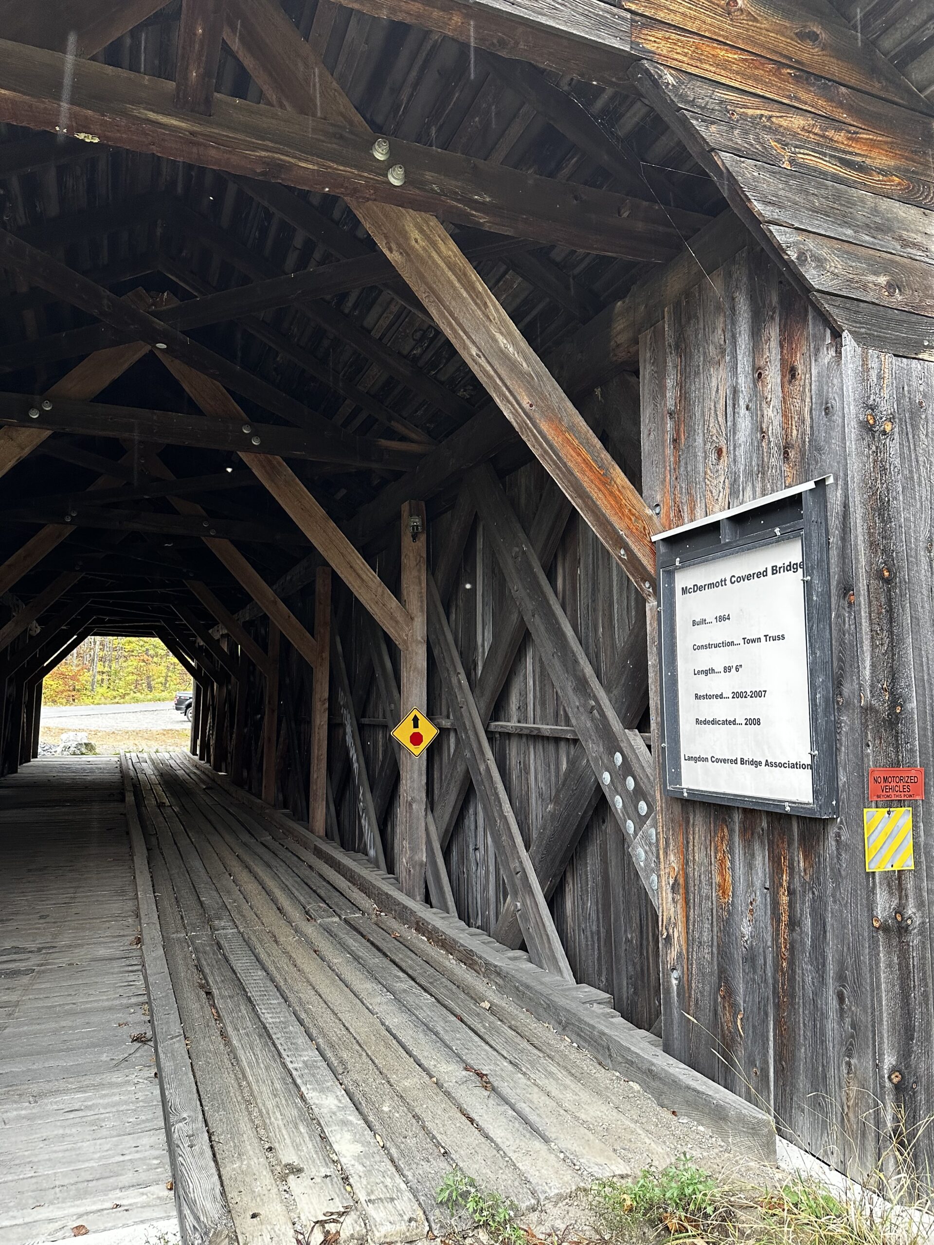
Informational Sign inside McDermott Bridge. Image Credit: Madeline Ferland.

Outside View of the Bridge and Town Sign. Image Credit: Madeline Ferland.
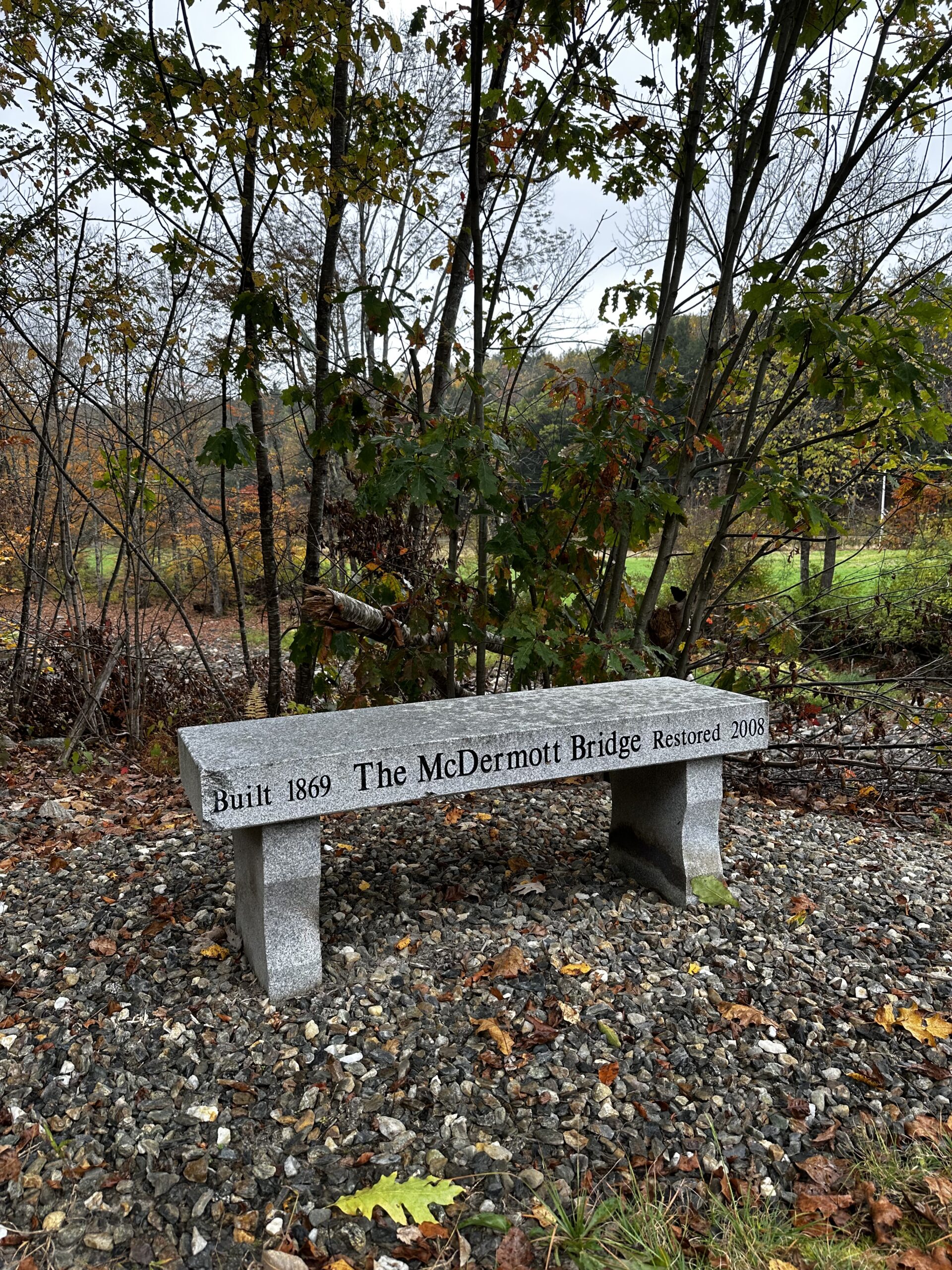
The McDermott Bridge Bench. Image Credit: Madeline Ferland.

Interior of McDermott Bridge. Image Credit: Madeline Ferland.
Prentiss Covered Bridge
Prentiss Covered Bridge is the southernmost covered bridge in the Sugar River Region, located in Langdon just south of Route 12A over the great Brook and not far from Fall Mountain Regional High School. Its exact date of construction isn’t known, but the second version of the bridge was finished in 1791. In 1805, the Cheshire Turnpike Company assimilated it as part of the turnpike until it was bypassed in 1954. The Prentiss bridge is now only a footbridge.
Fun Fact: Prentiss Covered Bridge, also known as Drewsville Covered Bridge, is the shortest covered bridge in New Hampshire.
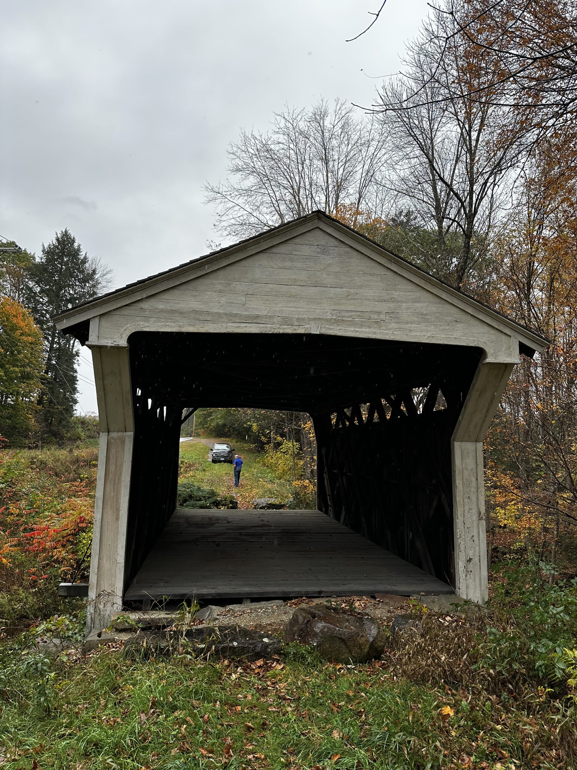
Prentiss Covered Bridge. Image Credit: Madeline Ferland.
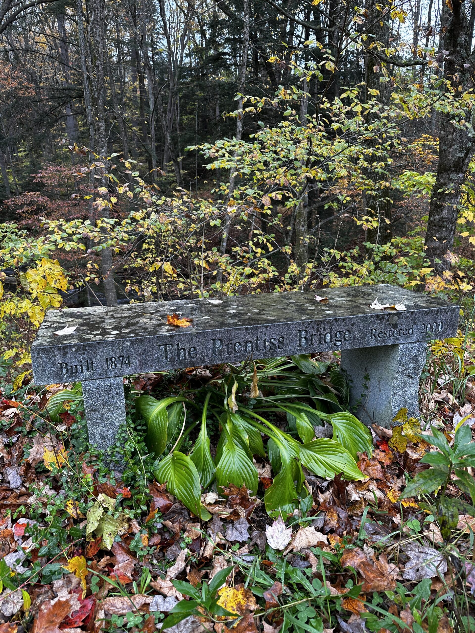
Prentiss Bridge Bench. Image Credit: Madeline Ferland.
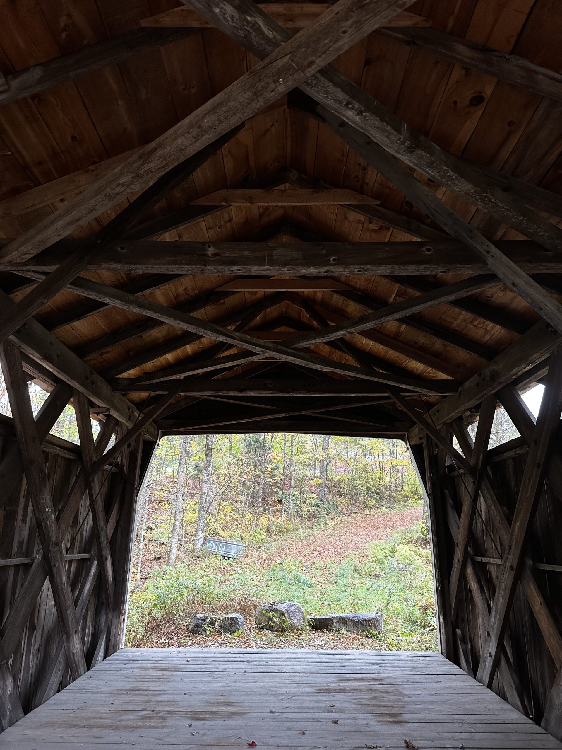
Interior of Prentiss Covered Bridge. Image Credit: Madeline Ferland.
Cornish-Windsor Covered Bridge
The Cornish-Windsor Covered Bridge is a beautiful example of 19th-century engineering and architecture and is probably, if not the most, well-known covered bridge in the Sugar River Region. It spans the Connecticut River and connects the towns of Cornish, New Hampshire, and Windsor, Vermont. It was built in 1866 and is the longest wooden covered bridge in the United States and the longest two-span covered bridge in the world.
Fun fact: The bridge was featured on a “Wonders of America” stamp issued by the United States Postal Service in 2006.
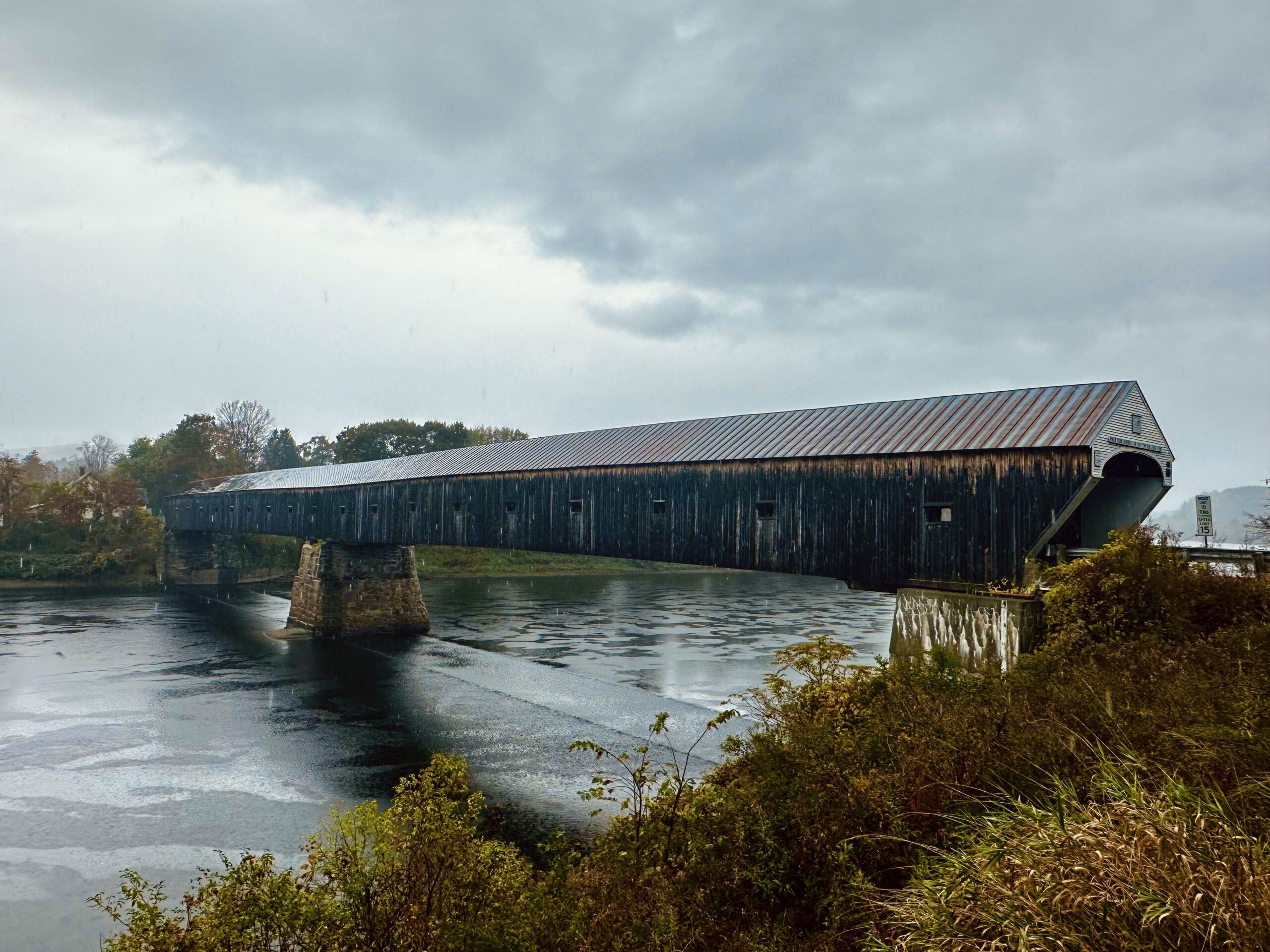
Side View of the Cornish-Windsor Bridge. Image Credit: Madeline Ferland.
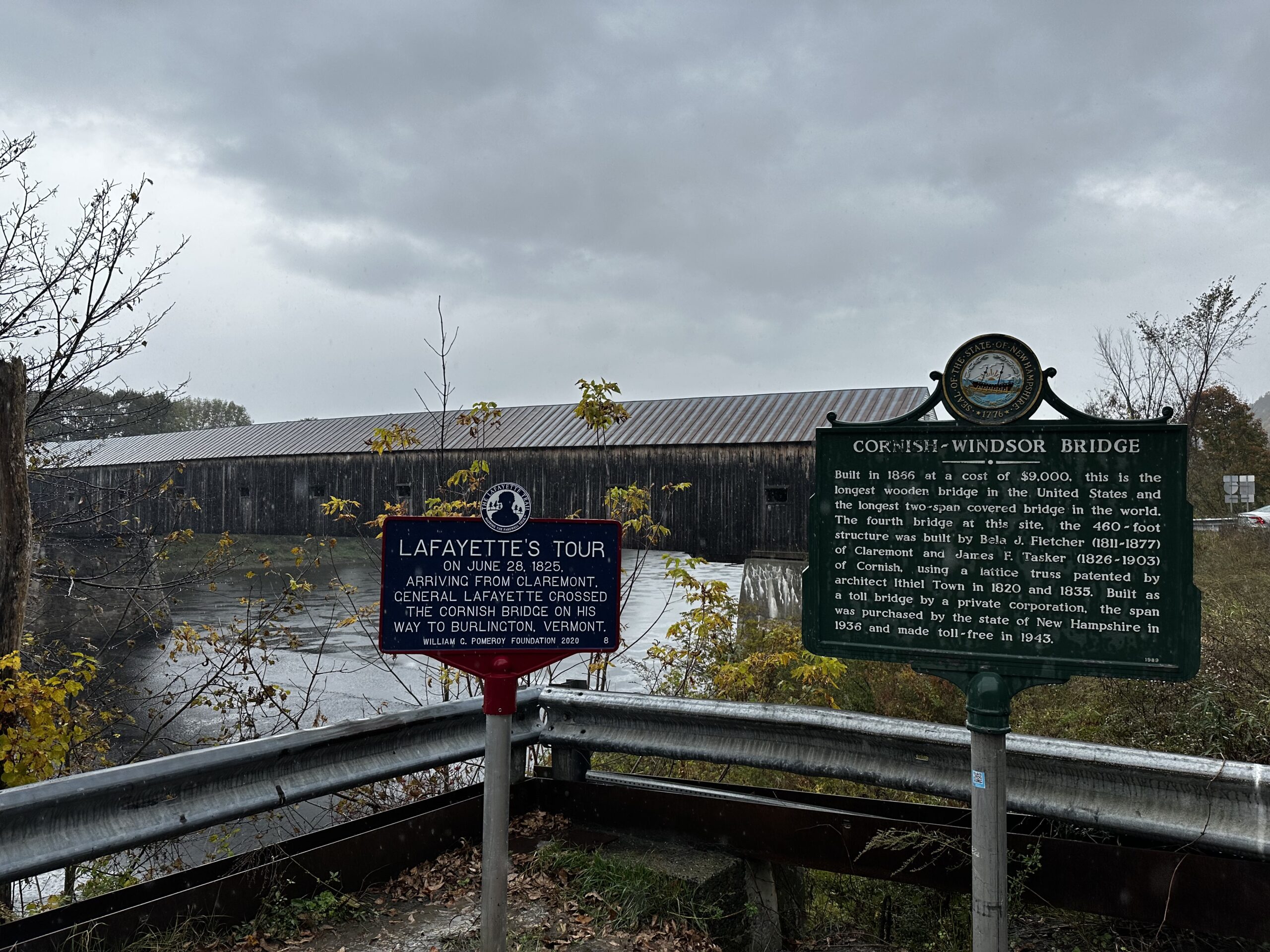
Lafayette’s Tour and Informational Signs. Image Credit: Madeline Ferland.

“Walk Your Horse or Pay Two Dollars Fine” Cornish-Windsor Covered Bridge. Image Credit: Madeline Ferland.
Dingleton Hill Covered Bridge
The Dingleton Hill Covered Bridge is located just off of Route 12A in Cornish, south of both Blow-Me-Down and the Cornish-Windsor bridges. It was constructed in 1882 as a single lane bridge and still allows for vehicle traffic. It was named for its location, as it’s close to Dingleton Hill and the road of the same name (but not actually on that road).
Fun Fact: The bridge was also built by James Tasker and October 23, 1983, was rededicated with his great-grandnephew Hyland Tasker present.
Dingleton Hill Covered Bridge. Image Credit: Madeline Ferland.
Interior of Dingleton Hill Bridge. Image Credit: Madeline Ferland.

Bridge View. Image Credit: Madeline Ferland.
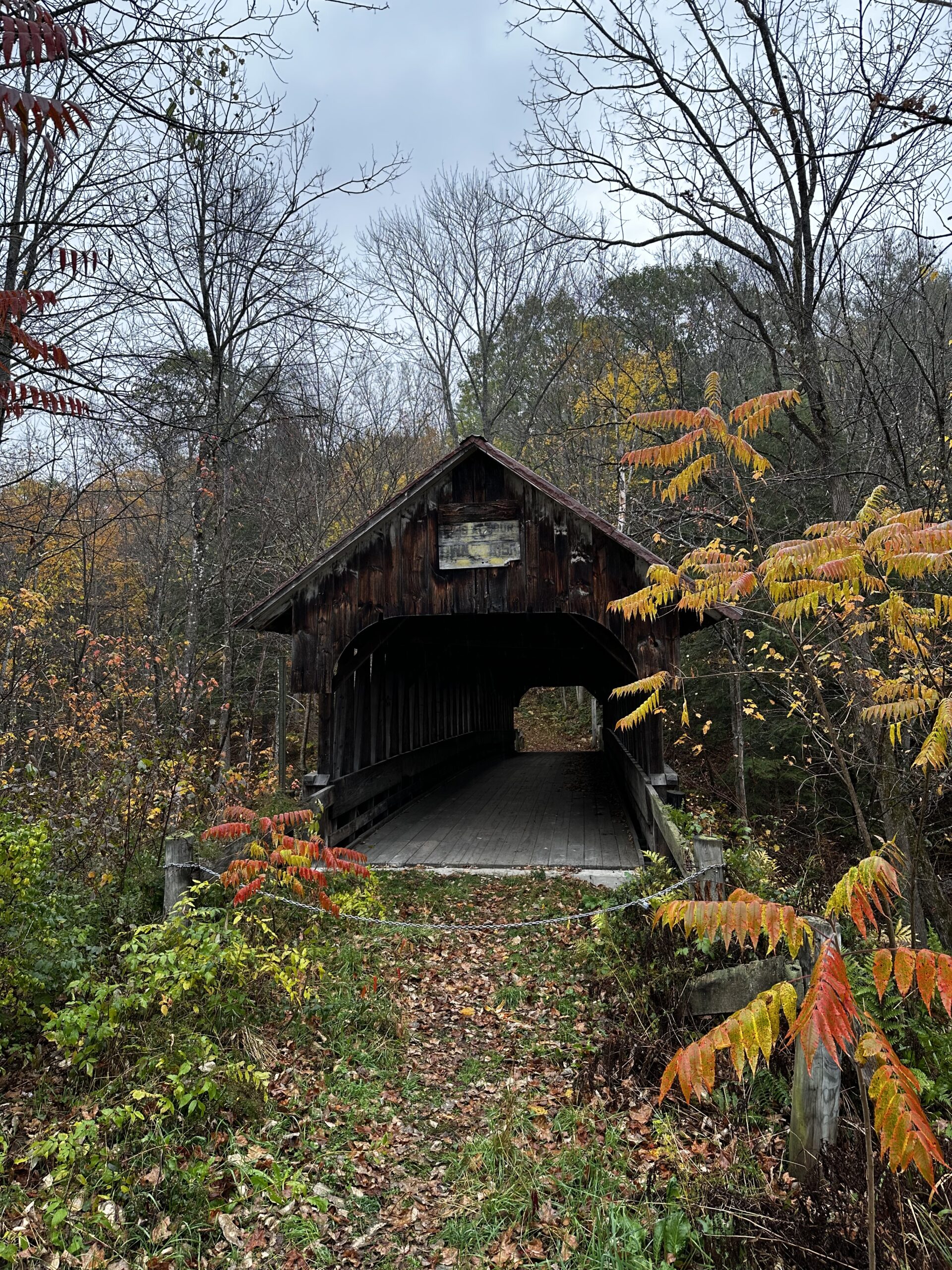
Blacksmith Covered Bridge
Blacksmith Covered Bridge was constructed in 1881 also by James Tasker and is a total hidden gem since it’s much lesser known than the others in the Sugar River Region! It’s a footbridge tucked in the trees just off of 12A over Mill Brook, a couple hundred feet past Dingleton if you continue on the same road. Keep an eye out for the brown sign stating Covered Bridge number 21.
Fun Fact: Blacksmith Bridge is also referred to as “Kenyon Bridge” for Kenyon Hill, which is a property east of the bridge.
Blacksmith Covered Bridge. Image Credit: Madeline Ferland.
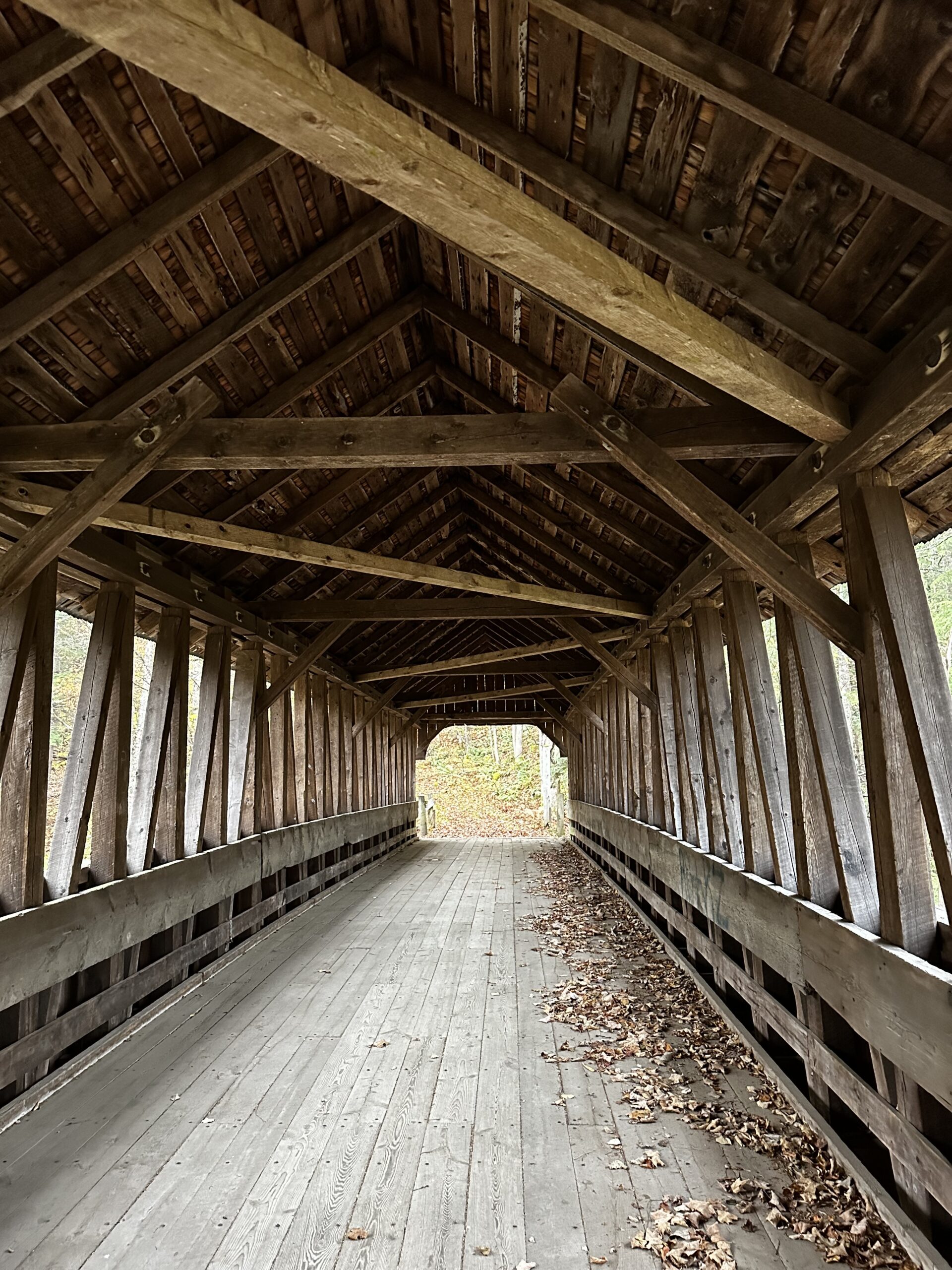
Blacksmith Covered Bridge Interior. Image Credit: Madeline Ferland.

Sign for the Blacksmith Covered Bridge. Image Credit: Madeline Ferland.
Path to the Bridge, Hidden in the Trees. Image Credit: Madeline Ferland.
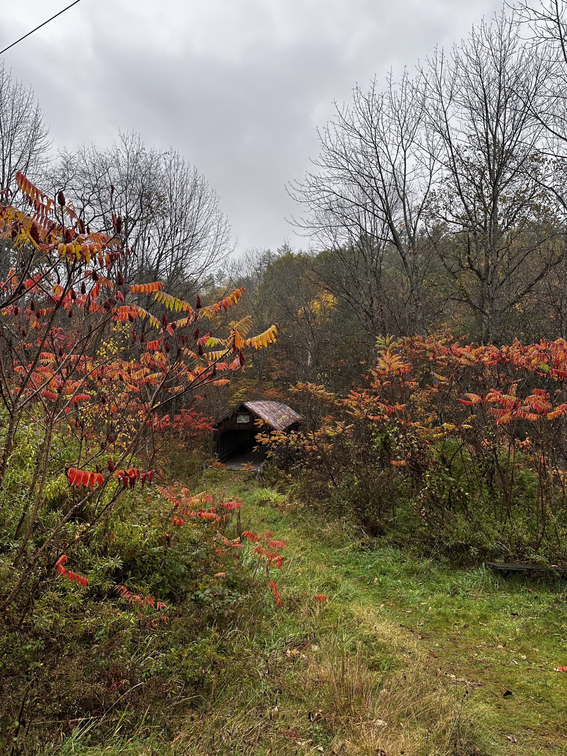
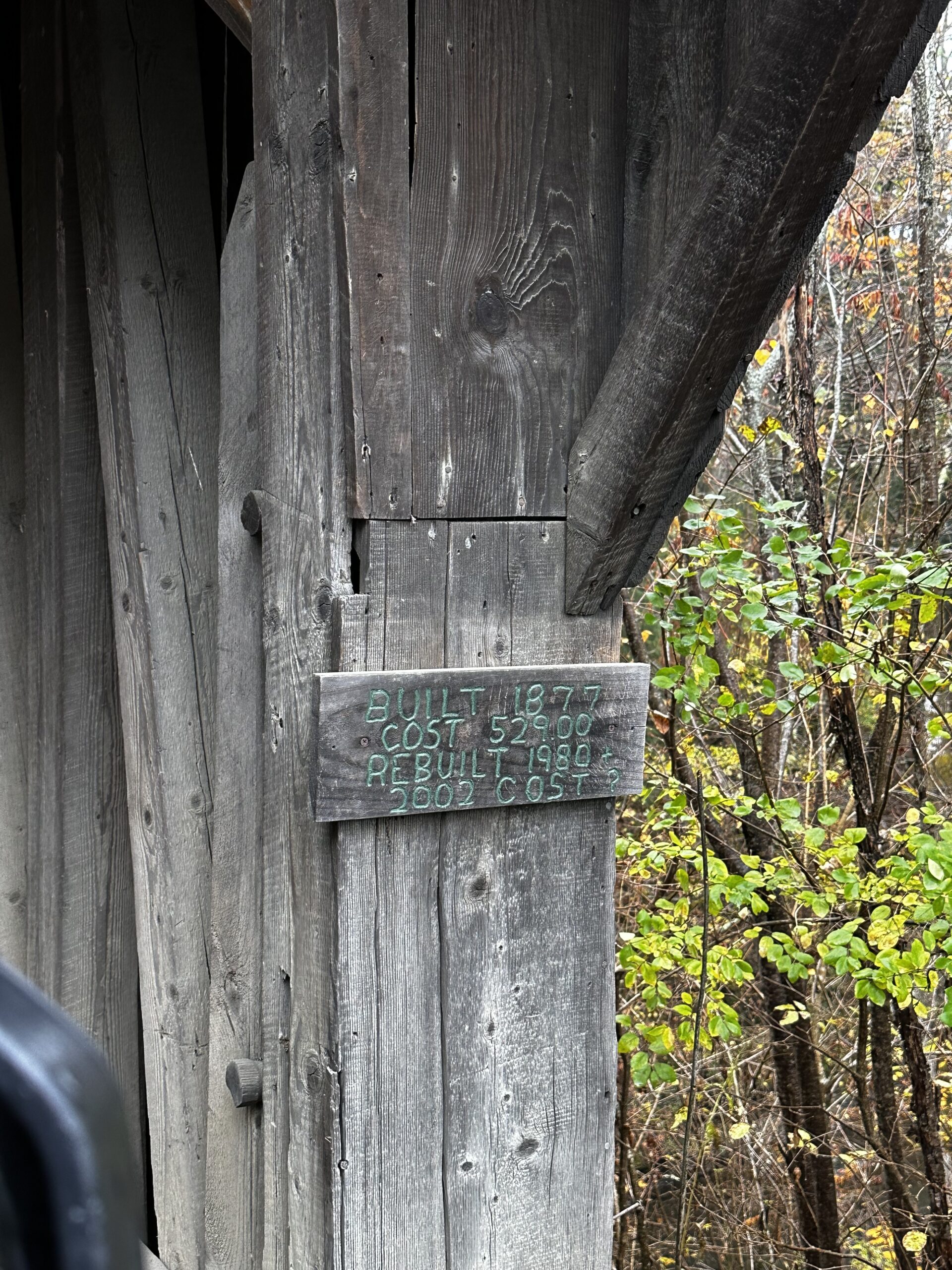
Blow-Me-Down Covered Bridge
The Blow-Me-Down Covered Bridge is named for the brook that it spans and is located just off of Route 12A in Cornish. It is also just down the road from Augustus St. Gaudens National Historic Park. Blow-Me-Down is a single lane bridge that allows for vehicle traffic. In 1877, the bridge was completed by James Tasker, one of the many constructed by him.
Fun Fact: The ceiling structure of the bridge includes diagonal cross beams that prevent tall vehicles from passing through, so make sure your car is less than seven feet high!
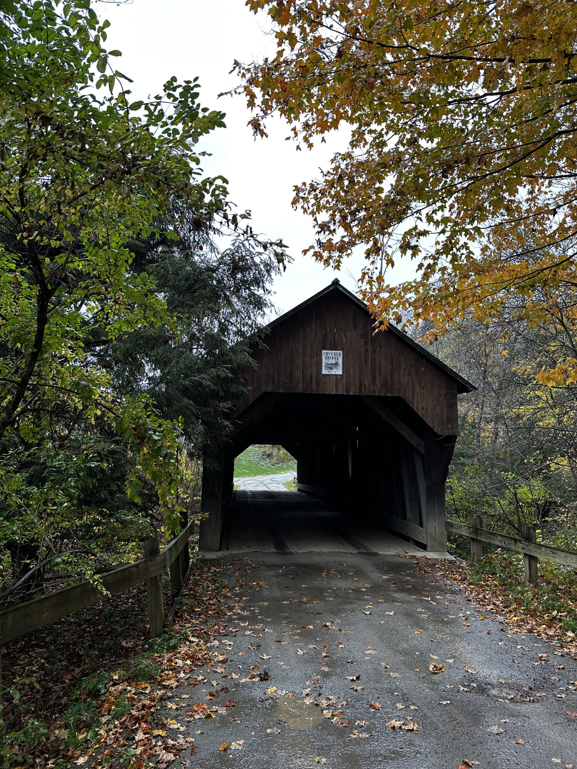
Blow-Me-Down Covered Bridge. Image Credit: Madeline Ferland.
Sign for the Blow-Me-Down Covered Bridge. Image Credit: Madeline Ferland.
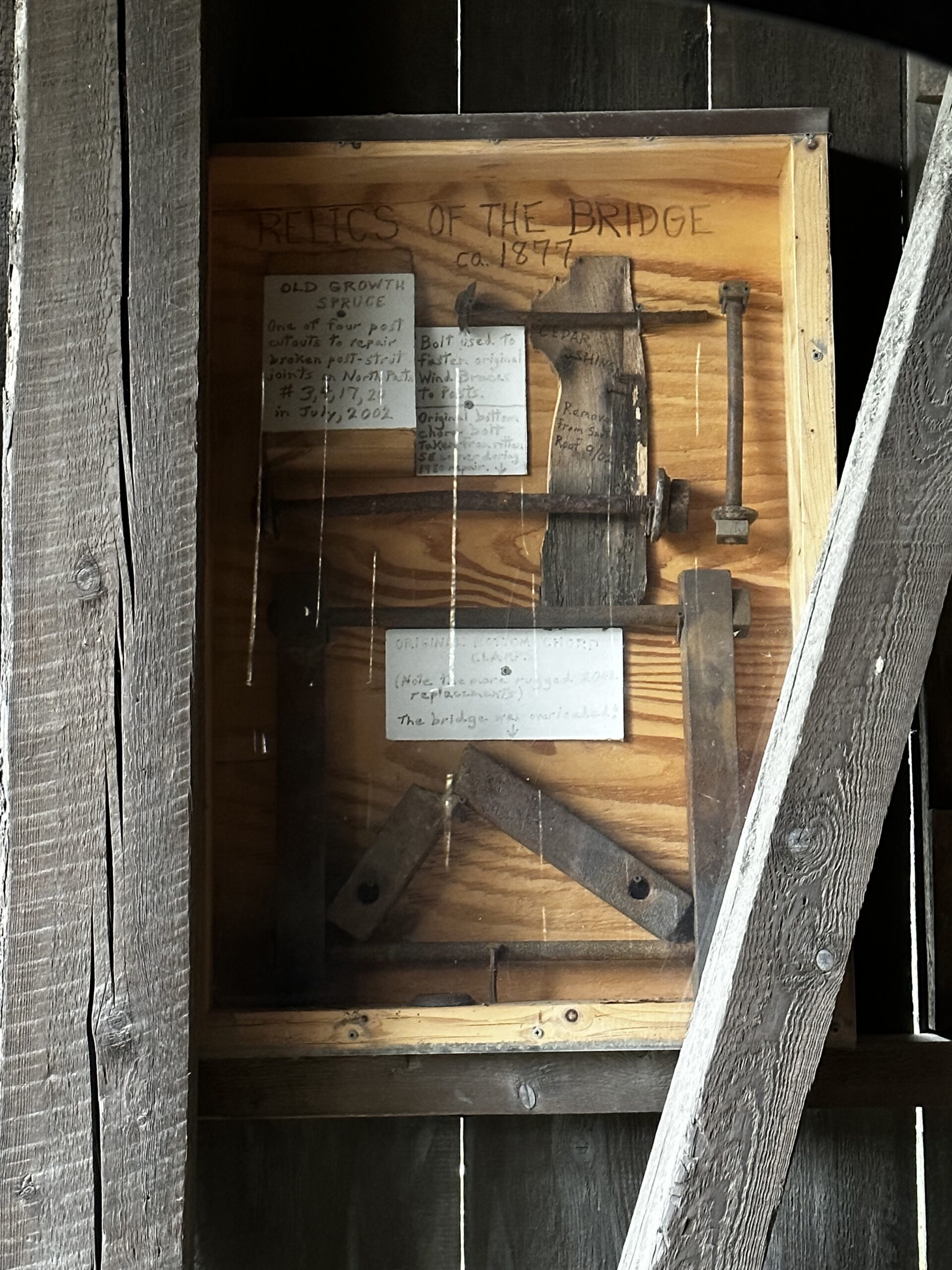
Relics from the Blow-Me-Down Covered Bridge. Image Credit: Madeline Ferland.
Meriden Covered Bridge
The Meriden Bridge is located on Colby Hill Road, just off of Route 120 in the town of Plainfield and spans Blood Brook. Also known as Mill Bridge, it was first built in 1880. The current structure is the third version, as the first two were constructed of timber and destroyed or damaged. Today it still allows for vehicle traffic.
Fun Fact: Under the bridge is a small waterfall that pools into a popular swimming hole – well known by locals and students of the nearby Kimball Union Academy. It’s a fantastically refreshing place to swim in the summer!
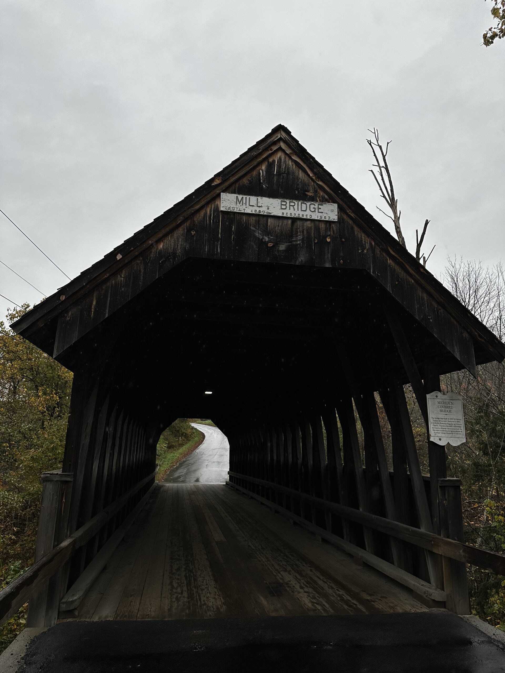
Meriden Covered Bridge, aka Mill Bridge. Image Credit: Madeline Ferland.
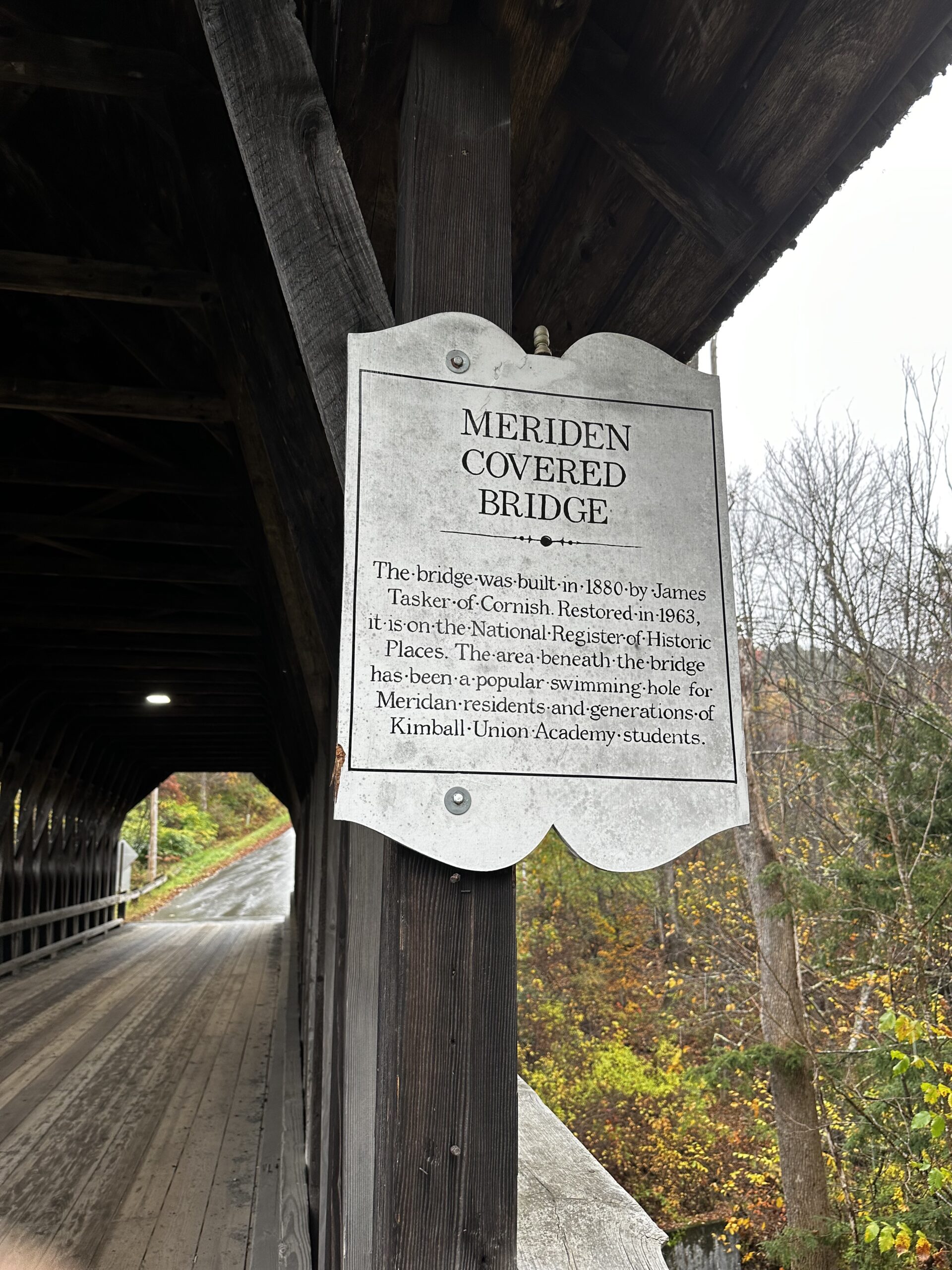
Sign at Meriden Covered Bridge. Image Credit: Madeline Ferland.
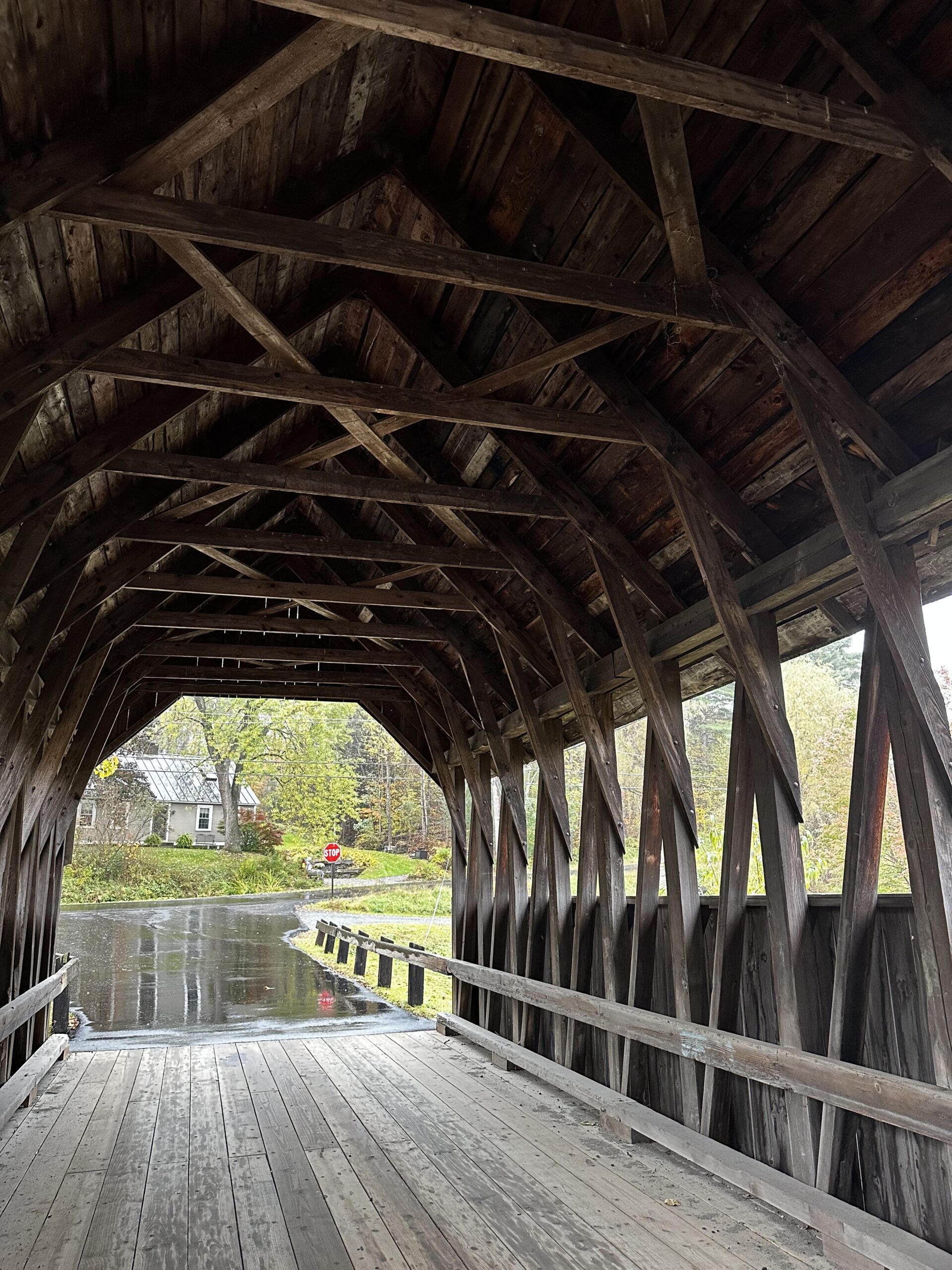
Meriden Covered Bridge Interior. Image Credit: Madeline Ferland.
Did you enjoy this driving tour of the Sugar River Region’s ten historic covered bridges? If so, make sure you plan some time to drive it yourself with friends and family. The covered bridges are an important part of the Sugar River Region identity, and we can celebrate our heritage by being a tourist in the region and seeing the bridges for ourselves. You won’t regret visiting such neat architectural pieces of history!Want to see more on the historic covered bridges or information on our heritage? Don’t forget to like us on Facebook, follow us on Instagram, and check out the Historic Covered Bridges page on our website!