Spring Hikes in Sullivan County & Trail Treasures
Spring Hikes in Sullivan County & Trail Treasures
Sullivan County, NH boasts an extensive network of trails that wind through diverse landscapes, offering ample opportunities for exploration and adventure. From the Monadnock-Sunapee Greenway to Pillsbury State Park, there’s a trail for every skill level. Trek through forests, across babbling brooks, and up to stunning viewpoints over the Sugar River Region. Whether you’re seeking a leisurely spring hike or an exhilarating mountain summit experience, our trails promise discovery and outdoor enjoyment.
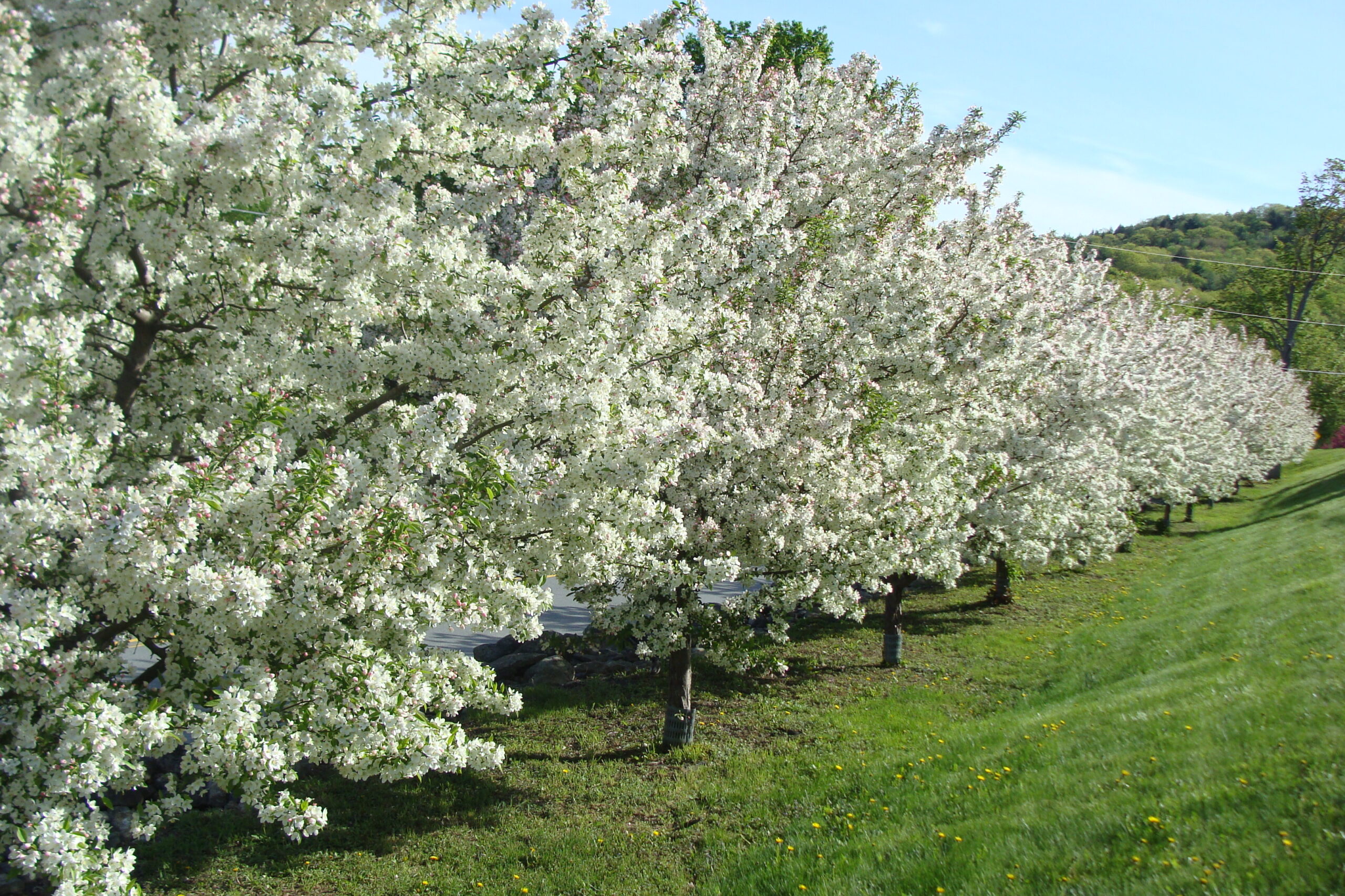
Spring Blossoms at the County Complex. Image Credit: Sullivan County Government.
Spring Hikes and Trails to Tick off Your List:
- Mount Sunapee State Park: This state park offers opportunities for hiking, picnicking, swimming, and camping. In the spring, you can enjoy hiking trails that lead to panoramic views of Lake Sunapee and the surrounding mountains. The park also features a network of mountain biking trails for outdoor enthusiasts.
- Dartmouth-Lake Sunapee Region: The Sugar River Region is part of the Dartmouth-Lake Sunapee Region, as per the NH Tourism Board, which encompasses charming towns, pristine lakes, and scenic landscapes. Visitors can explore quaint villages, go boating or fishing on Lake Sunapee, or hike sections of the Appalachian Trail that pass through the region.
- Monadnock-Sunapee Greenway: The Monadnock-Sunapee Greenway is a 48-mile hiking trail that traverses the rugged terrain of southwestern New Hampshire, including parts of Sullivan County. In the spring, hikers can enjoy the budding trees, wildflowers, and scenic vistas along the trail.
- Monadnock State Park: While primarily located in Cheshire County, Monadnock State Park is easily accessible from Sullivan County and offers some of the best hiking opportunities in the region. Mount Monadnock, the centerpiece of the park, is a popular destination for hikers seeking panoramic views of the surrounding landscape.
- Lake Sunapee Harbor: Lake Sunapee Harbor is a picturesque spot where visitors can enjoy scenic boat tours, paddleboarding, kayaking, or simply strolling along the waterfront. In the spring, you can witness the gradual thawing of the lake and the emergence of wildlife along its shores.
- Goshen Ocean Loop: The Ruth LeClair Memorial Trail is a three-mile loop around Gunnison Lake, commonly referred to as Goshen Ocean. This loop is an easy hike with gorgeous views of the lake and provides many great swimming locations just off the path.
- Helen Woodruff Bird Sanctuary Trails: There are 1.6 miles of trails within the forested sanctuary in Plainfield that make for great hiking or taking a walk. Multiple points of interest are along the trails, such as a stone bird bath, memorial plaques near the entrance, and a natural theater glade.
- Cornish Town Forest: The Cornish Town Forest trails network encompasses over 8 miles total of multi use trails. The forest terrain has great vantage points such as Wellman’s Hill and provides connections to neighboring trail networks like the Lipfert Forest trails.
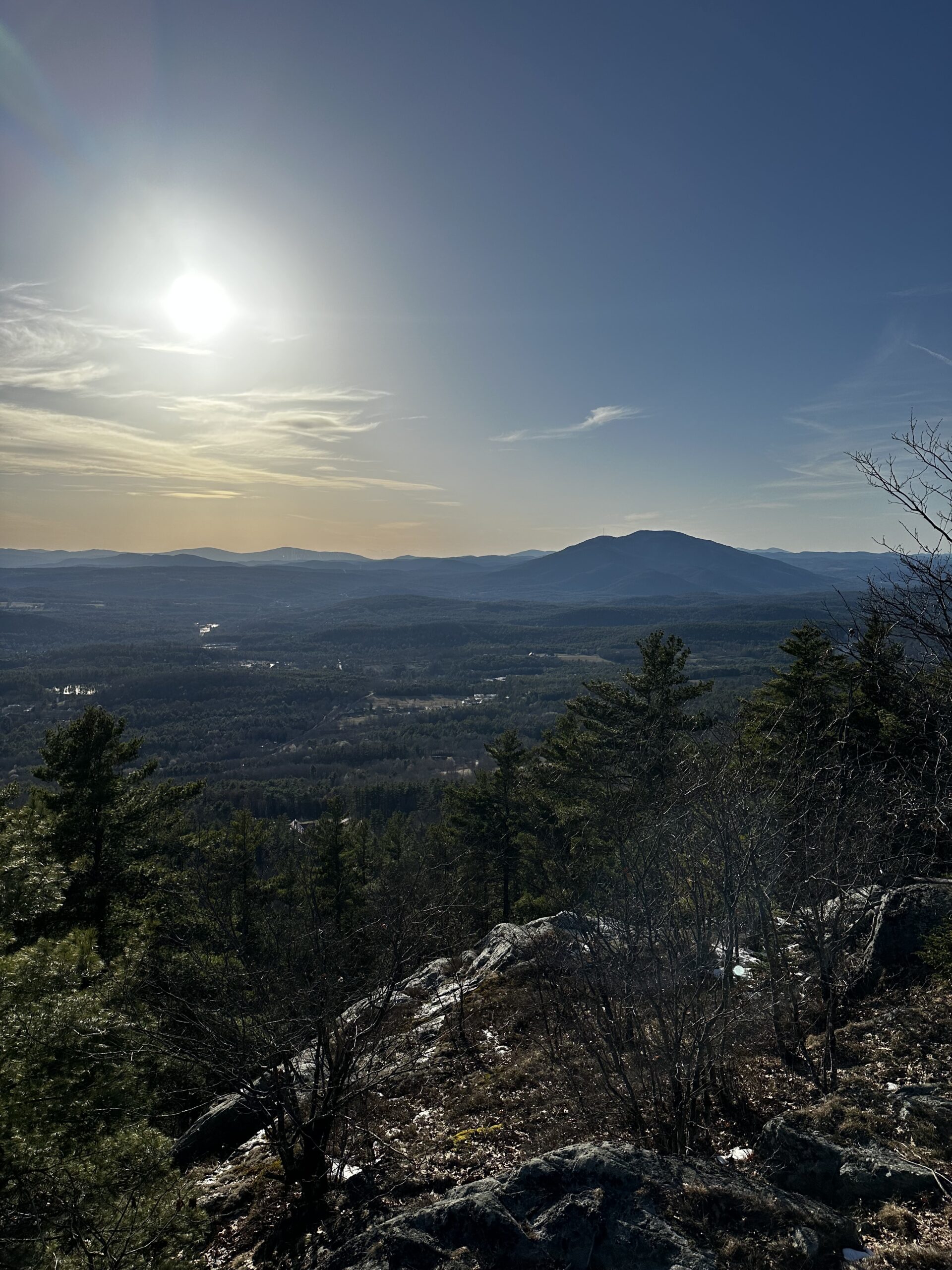
View from the Top of Cat Hole Hiking Trail in Claremont. Image Credit: Madeline Ferland.
Unique Trail: Sugar River Recreational Rail Trail
The picturesque Sugar River Trail spans 9.7 miles from Newport to Claremont, winding along the banks of the Sugar River. Always keep a vigilant eye out for deer, rabbit, beaver, raccoon, fox, wild turkey, and even the occasional moose. The trail’s surface varies from firm cinder/ballast to soft sand, particularly in the first 2 miles west from the Newport trailhead.
Adding to its charm, the Sugar River Trail features captivating river crossings and boasts two historic covered bridges that enhance the experience for enthusiasts. The Pier Bridge, and Wright’s Bridge, named after S.K. Wright, (facilitated the right-of-way sale to the Sugar River Railroad), were both constructed by the Boston & Maine Railroad. They are also both listed on the National Register of Historic Places. Unlike other covered bridges in New England, these structures are narrower and taller – with 21 feet of vertical clearance. The trail also has myriad other bridges – ranging from wooden plank structures and steel truss bridges.

Sugar River Recreational Rail Trail Map. Image Credit: Trail Finder.
ATVs with a width of up to 50 inches and weighing less than 1,000 pounds and trail bikes are permitted. For inquiries regarding OHRV registrations, agent locations, laws, or safety education courses, contact the NH Fish & Game Department. Revenue generated from registrations supports the construction and upkeep of OHRV trails across New Hampshire.
Should the trail inspire further exploration, consider concluding your day with additional activities in the region. Nearby, two state parks offer opportunities for hiking, fishing, boating, camping, or simply relaxing in nature. Mt. Sunapee State Park has a beach for a post-trail swim and where you can rent kayaks and canoes. In Washington, Pillsbury State Park boasts densely wooded trails perfect for hiking and mountain biking enthusiasts. Both parks offer seasonal camping options; for reservations, fees, and operating hours, please contact park authorities.

Pillsbury State Park Entrance in Washington, NH. Image Credit: Sullivan County Government.
Spring Hikes & Trail Safety Tips
Spring trail safety is paramount as outdoor enthusiasts venture into nature to enjoy the warmer weather and budding landscapes. Here are some essential tips to ensure a safe and enjoyable springtime hiking experience:
- Check trail conditions: Spring brings melting snow, rain, and fluctuating temperatures, which can affect trail conditions. Before heading out, check weather forecasts and trail reports for any closures, flooding, or hazardous conditions. Be prepared for muddy and slippery sections on the trails.
- Wear appropriate footwear: Sturdy, waterproof hiking boots with good traction are essential for navigating muddy and uneven terrain. Proper footwear will provide stability and help prevent slips and falls.
- Dress in layers: Spring weather can be unpredictable, with temperature changes throughout the day. Dress in layers that can be easily added or removed to regulate body temperature. Bring a waterproof jacket or shell to protect against rain showers or chilly winds.
- Stay hydrated: Even in cooler temperatures, it’s important to stay hydrated while hiking. Bring an adequate supply of water and drink regularly to prevent dehydration. Consider bringing a water filtration system or purification tablets if you plan to refill your water from natural sources.
- Watch out for wildlife: Springtime is when many animals come out of hibernation or become more active, including bears, snakes, and insects. Be aware of your surroundings and watch for wildlife on the trails. Keep a safe distance and avoid approaching or feeding wild animals.
- Bring essential gear: Pack essential hiking gear, including a map, compass or GPS device, first aid kit, whistle, flashlight or headlamp with extra batteries, multi-tool or knife, and emergency shelter. Consider carrying a fully charged mobile phone for emergencies, but be aware that service may be limited in remote areas.
- Beware of ticks: Spring is the prime season for ticks, which can transmit diseases such as Lyme disease. Wear long sleeves, pants, and insect repellent containing DEET to protect against ticks. Perform regular tick checks on yourself, your children, and pets after hiking in wooded or grassy areas.
- Leave No Trace: Practice Leave No Trace principles by staying on designated trails, disposing of waste properly, and respecting wildlife and other trail users. Leave the natural environment as you found it to preserve its beauty for future generations.
Did you enjoy this blog on the springtime hikes on the Sugar River Region’s Trails? Let us know if we missed any other trails that should be written about! Contact us atAdmin@SugarRiverRegion.org or submit a Contact Us form.
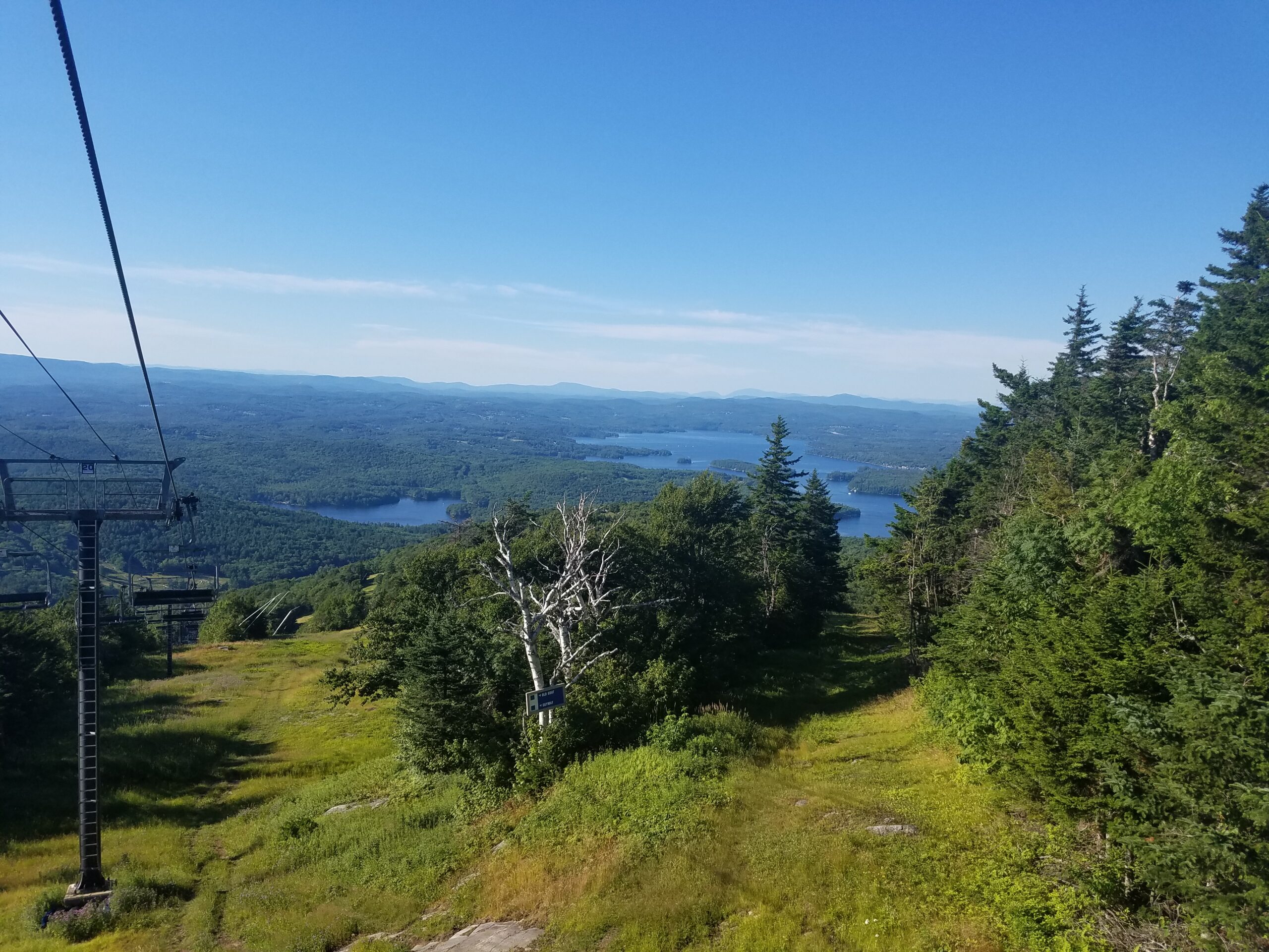
View from the Top of Mount Sunapee and Lake Sunapee. Image Credit: Sullivan County Government.
Written by Halle Swets on April 10, 2024.